

|
|
|

|
|

|
|
| FIRE HISTORY | ||||||||||
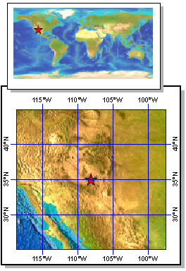
Grissino-Mayer fire data from Cerro Bandera North - IMPD USCBN001 |
||||||||||
|---|---|---|---|---|---|---|---|---|---|---|
 |
Start Year: 1361 AD End Year: 1993 AD Data: Please Cite Data Contributors! Fire Scar Data: uscbn001.fhx More Info: uscbn001.txt Fire History Graph: uscbn001-fire-hist-graph.pdf Fire History Graph: uscbn001-fire-hist-graph.png |
|||||||||
Summary:Records of past fire occurrence from tree rings, charcoal found in lake sediments, and other proxies. Parameter keywords describe what was measured in this data set. Additional summary information can be found in the abstracts of papers listed in the data set citations. Additional information on the International Multiproxy Database (IMPD) data set procedures are also available.More Info on Paleofire Data |
||||||||||
Parameters:Pinus ponderosa Douglas ex C. Lawson |
||||||||||
Complete XML Record:noaa-fire-2199 (Last Revised: 2008-07-24 ) |
||||||||||
|
||||||||||