Skip main navigation
HomeSearchSitemap   
  

NOAA logo

NOAA GLERL header

  GLERL logo
Skip Research subnavigation

Research Programs

By Region

By Subject

By Researcher

Publications

Milestone Reports


Great Lakes Water Levels

Grand Haven South Pier lights photo
Grand Haven South Pier lights. Photo by Carl Ter Haar.

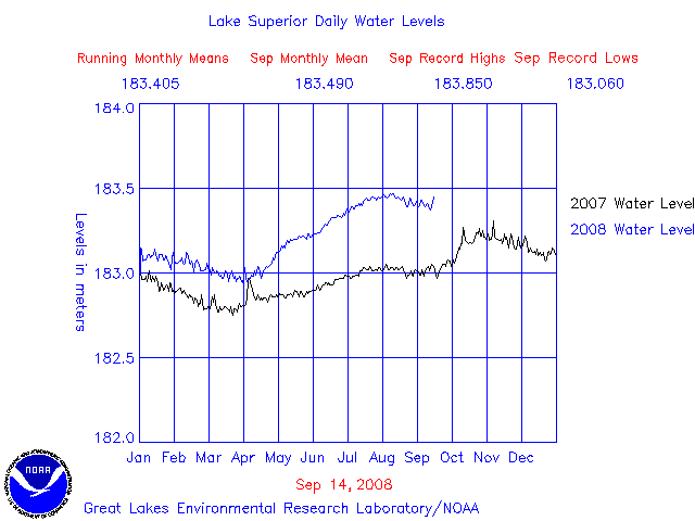
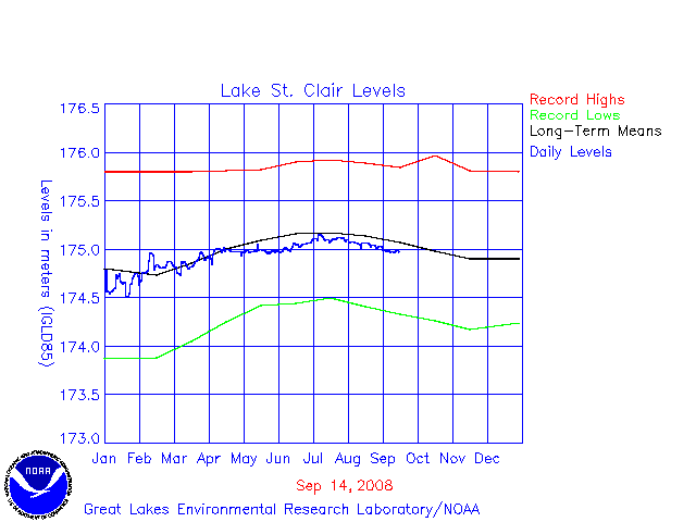
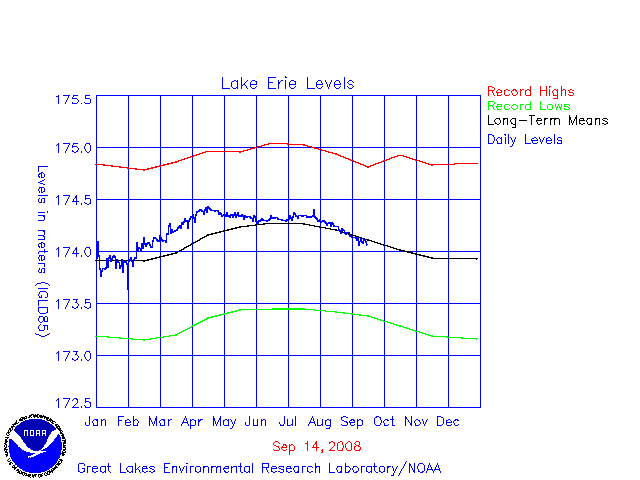
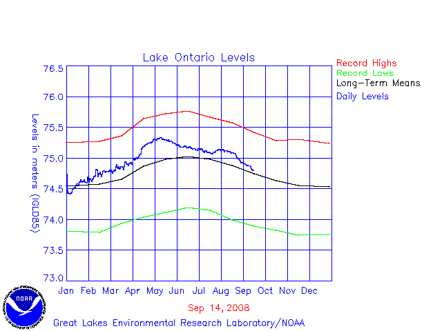
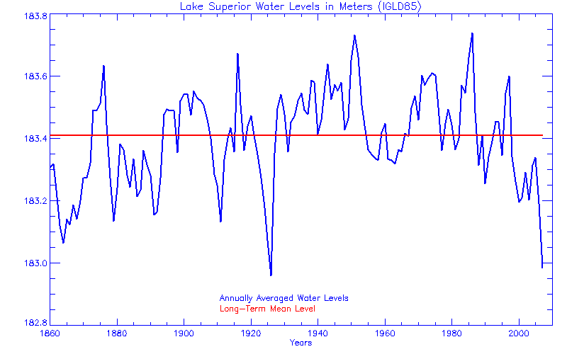
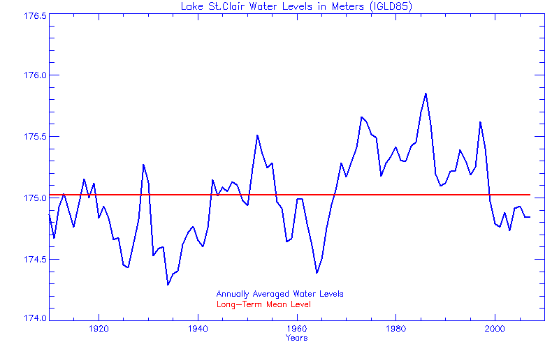
Great Lakes water levels constitute one of the longest high quality hydrometeorological data sets in North America with reference gage records beginning about 1860 with sporadic records back to the early 1800's.  These levels are collected and archived by NOAA's National Ocean Service.

Water Level Plots

Superior--Daily levels compared with last year's level
Michigan, Huron, St. Clair, and Erie-- Daily levels compared with last year's level
Ontario-- Daily levels compared with last year's level
Superior--Daily levels compared with monthly Min, Max, and Mean levels
Michigan-Huron--Daily levels compared with monthly Min, Max, and Mean levels
St. Clair--Daily levels compared with monthly Min, Max, and Mean levels
Erie--Daily levels compared with monthly Max, Min, and Mean levels
Ontario--Daily levels compared with monthly Max, Min and Mean levels

NOTE: The above plots contain raw data that have not been subjected to the National
Ocean Service's quality control or quality assurance procedures and do not meet the
criteria and standards of official National Ocean Service data. They are released for
limited public use as preliminary data to be used only with appropriate caution.

Water Level Gages

The following Reference Gages represent the levels on each lake:

Lake:

Superior
Michigan-Huron
St. Clair
Erie
Ontario

Gage:

Marquette
Harbor Beach
St. Clair Shores
Cleveland
Oswego

The long-term mean levels are averaged for data for the period of 1900 - 1990.

The Great Lakes

Great Lakes shoreline
  Photo by Ron Kinnunen.

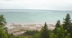
The Great Lakes Basin is located along the international boundary between Canada and the United States. The Basin includes portions of eight states: Minnesota, Wisconsin, Illinois, Indiana, Michigan, Ohio, Pennsylvania, and New York; and the province of Ontario. Lakes Superior, Michigan, Huron, Erie and Ontario compose the Great Lakes system. Combined, these lakes make up the largest surface fresh water body in the world.


Contact:

Cynthia Sellinger
Ph:  734 741 2385
e-mail: cynthia.sellinger@noaa.gov

Last updated: 2008-01-08 gcm


For more information:

Lake Superior Hydrograph

Lakes Michigan-Huron Hydrograph

Lake St. Clair Hydrograph

Lake Erie Hydrograph

Lake Ontario Hydrograph

NOAA's Water Level Forecasts

NOAA WATER LEVEL DATA

GLERL's MONTHLY HYDROLOGIC DATA (1860-PRESENT)


Proceedings from Paleo Water Levels in the Great Lakes
(pdf)

La Nina Effects on the Great Lakes

Water Levels Brochure (pdf)

National Drought Summary

NOAA Climate Outlooks

NOAA's Ice Charts

GLERL'S HISTORICAL ICE COVER DATA

USGS Stream Flow

Great Lakes Water Levels Photo Gallery