Hazardous Weather Outlook
|
Hazard Specific Graphics |
|||
|
Thunderstorms |
Flooding |
Winter Weather |
|
|
|
|
|
|
|
Wind and Fog |
Excessive Temperatures |
Fire Danger |
|
|
|
|
|
|
|
2-3 Day Hazards Outlook |
4-7 Day Hazards Outlook |
||
|
|
|
||


View only the product text for printing.
000
FLUS43 KFSD 211004
HWOFSD

HAZARDOUS WEATHER OUTLOOK
NATIONAL WEATHER SERVICE SIOUX FALLS SD
503 AM CDT SUN SEP 21 2008

SDZ038>040-050-052>071-MNZ071-072-080-081-089-090-097-098-
IAZ001>003-012>014-020>022-031-032-NEZ013-014-221200-
AURORA-BEADLE-BON HOMME-BROOKINGS-BRULE-BUENA VISTA IA-
CHARLES MIX-CHEROKEE IA-CLAY-CLAY IA-COTTONWOOD MN-DAKOTA NE-
DAVISON-DICKINSON IA-DIXON NE-DOUGLAS-GREGORY-HANSON-HUTCHINSON-
IDA IA-JACKSON MN-JERAULD-KINGSBURY-LAKE-LINCOLN-LINCOLN MN-
LYON IA-LYON MN-MCCOOK-MINER-MINNEHAHA-MOODY-MURRAY MN-NOBLES MN-
OBRIEN IA-OSCEOLA IA-PIPESTONE MN-PLYMOUTH IA-ROCK MN-SANBORN-
SIOUX IA-TURNER-UNION-WOODBURY IA-YANKTON-
503 AM CDT SUN SEP 21 2008

THIS HAZARDOUS WEATHER OUTLOOK IS FOR SOUTHEAST SOUTH DAKOTA...
SOUTHWEST MINNESOTA...NORTHWEST IOWA...AND NORTHEAST NEBRASKA.

.DAY ONE...TODAY AND TONIGHT

THUNDERSTORMS...
SHOWERS AND A FEW THUNDERSTORMS ARE EXPECTED TO MOVE
NORTHEASTWARD ACROSS THIS AREA TONIGHT...ALTHOUGH THE ACTIVITY
MAY NOT MAKE IT AS FAR EAST AS JACKSON MINNESOTA TO STORM LAKE
IOWA. CONDITIONS ARE NOT VERY UNSTABLE TONIGHT...THEREFORE SEVERE
STORMS ARE NOT EXPECTED.

.DAYS TWO THROUGH SEVEN...MONDAY THROUGH SATURDAY

THUNDERSTORMS ARE EXPECTED TO OCCUR ONCE AGAIN MONDAY NIGHT.
CONDITIONS ARE FAIRLY UNSTABLE ALONG AND WEST OF THE JAMES RIVER
VALLEY MONDAY EVENING...WHERE SOME STORMS MAY BECOME SEVERE. AS
THE STORMS TRACK EAST AND NORTHEAST OVERNIGHT MONDAY
NIGHT...STABILIZING CONDITIONS SHOULD MEAN THAT THE CHANCES FOR
SEVERE WEATHER ARE MINIMAL APPROACHING THE I 29 CORRIDOR AND
POINTS EASTWARD.

.SPOTTER INFORMATION STATEMENT...

SPOTTER ACTIVATION WILL NOT BE NEEDED TODAY AND TONIGHT.

&&

FOR MORE INFORMATION PLEASE VISIT OUR WEBSITE AT
WWW.WEATHER.GOV/SIOUXFALLS. THIS INCLUDES THE GRAPHICAL HAZARDOUS
WEATHER OUTLOOK.

$$
Check our Local Products page for any Watches, Warnings or Advisories which may be in effect.
Additional Severe Weather Products
From the Storm Prediction Center:
 Mesoscale Discussions |
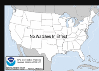 Convective Watches |
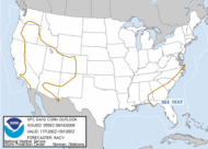
 Day 1 Convective Outlook |
 Day 2 Convective Outlook |
 Day 3 Convective Outlook |
 Day 1 Fire Weather Outlook |
 Day 2 Fire Weather Outlook |