|
Moderate Drought Develops |
|||||||||||||||||||||||||||||||||||||||||||||||||||||||||||||||||||||||||||||||||||||||||||||||||||||||||||||||||||||||||||||||||||||||||||||||||||||||||||||||||||||||||||||||||||||||||||
| Summary: | |||||||||||||||||||||||||||||||||||||||||||||||||||||||||||||||||||||||||||||||||||||||||||||||||||||||||||||||||||||||||||||||||||||||||||||||||||||||||||||||||||||||||||||||||||||||||||
|
From September 2nd through September 16th, much of the rain associated with the remnants of two Atlantic hurricanes (Gustav and Ike) and an Eastern Pacific Topical Storm (Lowell) moved just southeast of the abnormally dry (D0) and moderate drought (D1) areas of southeast Minnesota, northeast Iowa, and western Wisconsin. In our area, the heaviest rain fell across southeast Clayton County in northeast Iowa and southern and eastern portions of Grant County in southwest Wisconsin. Some rainfall totals included: Platteville, WI - 3.38"; Cuba City 2NW, WI - 3.33"; Guttenberg, IA - 2.23"; and Strawberry Point - 2.03". Meanwhile the remainder of our forecast area saw between a 0.50 and 1.50 inches of precipitation. The map below provides more detail on where this precipitation fell.
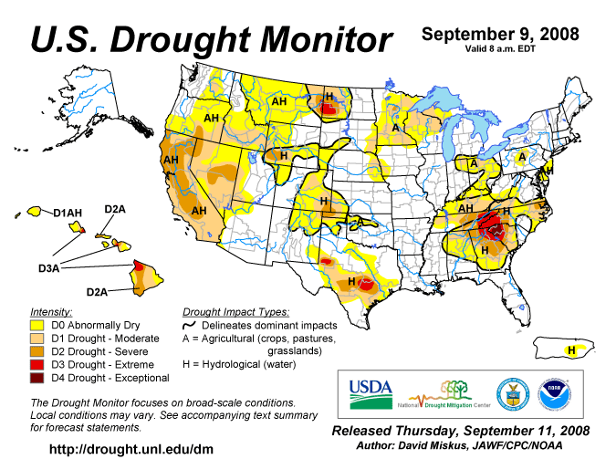
While this rain was beneficial, it did little to reduce the growing precipitation deficits across this region. Since mid June, the precipitation deficits in southeast Minnesota have grown into the 5 to 7 inch range. These precipitation deficits have resulted in a moderate drought (D1). In western Wisconsin and parts of northeast Iowa, the precipitation deficits have been mainly growing since mid to late July. During this time frame, precipitation deficits have grown into the 3 to 7 inch range. This has resulted in a moderate drought (D1) across much of west central and north central Wisconsin; and abnormally dry (D0) across the remainder of western Wisconsin and parts of northeast Iowa. This recent dryness is mainly affecting grass and other shallow rooted plants. In addition, many crops (such as corn and soy beans) are suffering, because their roots are much shallower than normal. This is due to the excessive wet soils during the earlier part of the growing season. These plants during their early development had adequate water to grow so their roots stayed near the surface. As the quick dryness set in, these roots were not able to grow down fast enough to tap into the moisture further down in the soil. This has affected the development of corn cobs and the filling of soy bean pods. Some yield losses have been noted in the agricultural reports during the past month. In addition, some fruit has been maturing smaller than normal due to this dryness too. In the September 16th release of the U.S. Drought Monitor, severe (D2) drought existed across a small part of north central Minnesota. Moderate drought (D1) existed from southeast South Dakota across southern Minnesota, the northern half of Wisconsin, and western Upper Michigan. In addition, moderate drought was found in the Minnesota Arrowhead. Abnormally dry (D0) surrounds the moderate drought (D1) area in southeast South Dakota, Minnesota, and southern Wisconsin. In addition, abnormally dry conditions (D0) can be found in eastern Nebraska, western Iowa, northeast Indiana, and Ohio.
Local Area Affected: Moderate drought (D1) conditions exist across Dodge, Olmsted, Winona, and Wabasha counties in southeast Minnesota; and in Buffalo, Taylor, and Trempealeau counties in western Wisconsin. Abnormally dry (D0) to moderate drought (D1) conditions exist across Fillmore, Houston, and Mower counties in southeast Minnesota; and in Clark, Jackson, La Crosse, and Monroe counties in western Wisconsin. Abnormally dry (D0) conditions exist across all or parts of Adams, Crawford, Juneau, Richland, and Vernon counties in western Wisconsin; and Allamakee, Mitchell, Howard, and Winneshiek counties in northeast Iowa.
State and Local Actions: Southeast Minnesota... Since mid June 2008, most locations in southeast Minnesota have seen between six and eight inches of precipitation. These totals are five to seven inches below normal. Normally this area receives around 13 inches of precipitation from mid June through mid September. Due to these precipitation deficits, moderate drought conditions (D1) continue to be found across all or parts of Dodge, Fillmore, Houston, Mower, Olmsted, Wabasha, and Winona counties. The table below shows how much precipitation has fallen and precipitation deficits across southeast Minnesota from June 15 through September 16, 2008.
Northeast Iowa & Western Wisconsin... Since mid July 2008, most locations in western Wisconsin and parts of northeast Iowa have seen between two and five inches of precipitation. These totals are three to seven inches below normal. Normally this area receives around eight inches of precipitation from mid July through mid September. Due to these precipitation deficits, moderate drought (D1) exists across all or parts of Buffalo, Clark, Jackson, La Crosse, Monroe, Taylor, and Trempealeau counties in western Wisconsin. Abnormally dry conditions (D0) exist across all or parts of Adams, Crawford, Juneau, Richland, and Vernon counties in western Wisconsin; and Allamakee, Mitchell, Howard, and Winneshiek counties in northeast Iowa. The table below shows how much precipitation has fallen and precipitation deficits across parts of northeast Iowa and western Wisconsin from July 20 through September 16, 2008.
|
The U.S. Drought Monitor is a weekly collaborative effort between a number of federal agencies including NOAA/NWS, U.S. Department of Agriculture and the National Drought Mitigation Center. Details and explanations of the Drought Monitor can found at the web site: http://www.drought.unl.edu/ The categories of drought are defined as follows: Moderate Drought (D1) - Some damage to crops, pastures; fire risk high; streams, reservoirs, or wells low, some water shortages developing or imminent, voluntary water use restrictions requested. Severe Drought (D2) - Crop or pasture losses likely; fire risk very high; water shortages common; water restrictions imposed. Extreme Drought (D3) - Major crop/pasture losses; extreme fire danger; widespread water shortages or restrictions. Exceptional Drought (D4) - Exceptional and widespread crop/pasture losses; exceptional fire risk; shortages of water in reservoirs, streams, and wells, creating water emergencies. |
||||||||||||||||||||||||||||||||||||||||||||||||||||||||||||||||||||||||||||||||||||||||||||||||||||||||||||||||||||||||||||||||||||||||||||||||||||||||||||||||||||||||||||||||||||||||||
Soil Moisture Conditions: |
|||||||||||||||||||||||||||||||||||||||||||||||||||||||||||||||||||||||||||||||||||||||||||||||||||||||||||||||||||||||||||||||||||||||||||||||||||||||||||||||||||||||||||||||||||||||||||
|
As of September 16th, the Midwestern Regional Climate Center (MRCC) indicated that the soil moisture in the top five feet ranged from 1.0 to 3.5 inches below normal from southwest Iowa northeast into the Minnesota arrowhead and Upper Michigan. The soils were the driest across southeast Minnesota and west central Wisconsin where the soils were 3.0 to 3.5 inches below normal. The image below is from the MRCC. Current Soil Moisture Deviation as of September 16, 2008 |
Additional information about soil moisture conditions can be found either at the Midwestern Regional Climate Center (MRCC) at: http://mcc.sws.uiuc.edu/ or at the NWS Climate Prediction Center (CPC) Web Site at: http://www.cpc.noaa.gov/products/soilmst/w.shtml
|
||||||||||||||||||||||||||||||||||||||||||||||||||||||||||||||||||||||||||||||||||||||||||||||||||||||||||||||||||||||||||||||||||||||||||||||||||||||||||||||||||||||||||||||||||||||||||
Ground Water Impacts: |
|||||||||||||||||||||||||||||||||||||||||||||||||||||||||||||||||||||||||||||||||||||||||||||||||||||||||||||||||||||||||||||||||||||||||||||||||||||||||||||||||||||||||||||||||||||||||||
|
On September 16th, the well water level just west of Tomah, Wisconsin (Monroe County) was 6.15 feet below ground level. This was a tenth of a foot lower than September 7th. Normally the water level should be 4.80 feet below ground level. The lowest water level on record was 8.62 feet below the ground level on October 7, 1987. The highest water level on record was 0.48 feet below ground level on September 29, 1965. The period of record extends from October 1949 through the present.
|
Additional information about ground levels can be found either at the USGS Ground-Water Climate Response Network at: http://groundwaterwatch.usgs.gov/
|
||||||||||||||||||||||||||||||||||||||||||||||||||||||||||||||||||||||||||||||||||||||||||||||||||||||||||||||||||||||||||||||||||||||||||||||||||||||||||||||||||||||||||||||||||||||||||
River and Stream Flow Conditions: |
|||||||||||||||||||||||||||||||||||||||||||||||||||||||||||||||||||||||||||||||||||||||||||||||||||||||||||||||||||||||||||||||||||||||||||||||||||||||||||||||||||||||||||||||||||||||||||
|
Below normal precipitation since mid summer has caused river levels to slowly fall. Currently the lowest flows are reported along the Black River in north central and west central Wisconsin; and along the South Fork of the Zumbro River in southeast Minnesota. Listed below are some current (September 16th) river and stream flows versus in cubic feet per second (cfs) compared to percentiles of historical daily stream flow for the day of the year. These are for selected rivers and streams in our service area with long periods (over 30 years) of record as measured by the United States Geological Survey (USGS).
|
Hourly and forecast river stages out to 90 days can be found at the National Weather Service's (NWS) Advanced Hydrologic Prediction Service (AHPS) web page: http://www.crh.noaa.gov/ahps2/ Additional Current stream and river stages may be viewed at the following USGS Web Site: |
||||||||||||||||||||||||||||||||||||||||||||||||||||||||||||||||||||||||||||||||||||||||||||||||||||||||||||||||||||||||||||||||||||||||||||||||||||||||||||||||||||||||||||||||||||||||||
Agricultural Impacts: |
|||||||||||||||||||||||||||||||||||||||||||||||||||||||||||||||||||||||||||||||||||||||||||||||||||||||||||||||||||||||||||||||||||||||||||||||||||||||||||||||||||||||||||||||||||||||||||
|
Minnesota: According to USDA, NASS, Minnesota Field Office on September 14th, the small grain harvest was nearly complete as the spring wheat crop reached 97 percent harvested during the past week. Precipitation received across the state was generally welcomed by farmers and increased top soil moisture supplies across much of the state. The majority of the soybean crop reached the yellowing stage of development while some of the earliest planted corn was mature. Crop progress of both corn and soybeans, however, remained behind last year and average.The average temperature for the week was 56.6 degrees, 3.0 degrees below normal. Statewide topsoil moisture supplies as of Friday, September 12th were 9 percent very short, 30 short, 55 adequate, and 6 surplus. Statewide, on average, there were 5.4 days suitable for fieldwork during the week. As of Sunday, September 14th, 97 percent of corn had reached the dough stage compared to 100 percent last year and 97 percent average. Eighty-one percent of corn was in the dent stage compared to 99 percent last year and 87 percent average. Corn was 6 percent mature, compared to 61 percent last year, and 31 percent average. Soybeans were 70 percent turning yellow compared to 94 percent last year and 83 percent average. Eighteen percent of soybeans were dropping leaves compared to 71 percent last year and 49 percent average. As of Friday, September 12th, 62 percent of corn and 65 percent of soybeans were rated in good or excellent condition. Sixty-five percent of dry beans, 77 percent of sunflowers and sugar beets, and 31 percent of pasture were rated in good or excellent condition. Wisconsin: On September 17th, the Wisconsin Field Office of USDA's National Agricultural Statistics Service (NASS) reported that some light frost was evident the early part of last week in northwestern Wisconsin. Farmers are hoping for more heat and more time before a killing frost arrives. While some areas of the state received much needed rains last week, other counties remained dry. One reporter from south central Wisconsin reported saturating rains last week, slowing down all fieldwork. However, most regions of the state continue to look for more moisture. The following were quotes from Farm Reporters and County Agriculture Agents: Clark County - The corn crop was continued to progress. It is mostly in the dough stage or early dent. Corn silage harvest is beginning. At a couple of burn down days, moistures were in the high 60's to low 70's percent total plant moisture. I have seen a large number of northern and western corn root worm beetles on corn plants this fall. Soybeans are maturing with leaf drop being noticeable this week. Soybean aphids are still found in the fields below thresholds. Some third crop hay is being made between showers. The weather has been dry in August which has reduced yields.
|
Soil moisture supply measures how much moisture is present in cropland top soil during the week. Soil moisture is reported as a percentage. The categories very short, short, adequate and surplus must add up to 100%.
For additional information on agriculture impacts may be viewed at the United States Department of Agriculture (USDA) National Agricultural Statistics Service NASS Web Site: http://www.nass.usda.gov/Publications |
||||||||||||||||||||||||||||||||||||||||||||||||||||||||||||||||||||||||||||||||||||||||||||||||||||||||||||||||||||||||||||||||||||||||||||||||||||||||||||||||||||||||||||||||||||||||||
Fire Danger Hazards: |
|||||||||||||||||||||||||||||||||||||||||||||||||||||||||||||||||||||||||||||||||||||||||||||||||||||||||||||||||||||||||||||||||||||||||||||||||||||||||||||||||||||||||||||||||||||||||||
|
As of the morning of September 16th, moderate fire danger was reported across central and north central Wisconsin. Meanwhile low fire danger was reported across southeast Minnesota, and in Taylor County in north central Wisconsin. The Keetch-Byram Drought Index (KBDI) remained moderate across southeast Minnesota; northeast Iowa; and western Wisconsin. With several days of dry and unseasonably warm weather, the 100-and 1000-hour dead fuel moisture has decreased into the 16 to 20 percent range across much of southeast Minnesota, northeast Iowa, and western Wisconsin. The 100-hour dead fuel moistures are more susceptible to short term dryness than the 1000-hour dead fuel moistures as a result there is more day to day variability associated with them. As a reminder, citizens should always check with local officials in their area before undertaking any outside burning. Citizens are liable for damages and suppression costs of any wildfire they may start. |
For updated DNR Fire Conditions consult the following Web Sites: In Minnesota: In Wisconsin: The Keetch-Byram Drought Index (KBDI) is a drought index that is specifically related to fire potential. The KDBI is broken into four categories which indicate the susceptibility of ground fuels to fire danger. Below are the four categories and a brief description of each.
KBDI and Dead Fuel Moisture data can be found on the Wildland Fire Assessment System (WFAS) web site at: |
||||||||||||||||||||||||||||||||||||||||||||||||||||||||||||||||||||||||||||||||||||||||||||||||||||||||||||||||||||||||||||||||||||||||||||||||||||||||||||||||||||||||||||||||||||||||||
Precipitation/Temperature Outlooks: |
|||||||||||||||||||||||||||||||||||||||||||||||||||||||||||||||||||||||||||||||||||||||||||||||||||||||||||||||||||||||||||||||||||||||||||||||||||||||||||||||||||||||||||||||||||||||||||
|
From September 18th through September 23rd, temperatures will average above normal and precipitation will average below normal. During this time frame, the daily average temperatures range from 56 to 61 degrees and the normal precipitation is between six and seven tenths of an inch. Beyond this time frame the 8 to 14 day forecast from the Climate Prediction Center (CPC) for the period September 24th through September 30th calls for above normal temperatures and precipitation. During this time frame, the daily average temperatures range from 54 to 59 degrees and the normal precipitation is between six and seven tenths of an inch. The seasonal outlook for October through December calls above normal temperatures; and equal chances for above, below, and near normal precipitation across the Upper Mississippi River Valley. |
For updated temperature and precipitation probabilities consult the following Climate Prediction Center (CPC) Web Sites: 8 to 14 Day Outlook: http://www.cpc.ncep.noaa.gov/ 30 Day Outlook: http://www.cpc.ncep.noaa.gov 90 Day Outlook: |
||||||||||||||||||||||||||||||||||||||||||||||||||||||||||||||||||||||||||||||||||||||||||||||||||||||||||||||||||||||||||||||||||||||||||||||||||||||||||||||||||||||||||||||||||||||||||
Questions or Comments: |
|||||||||||||||||||||||||||||||||||||||||||||||||||||||||||||||||||||||||||||||||||||||||||||||||||||||||||||||||||||||||||||||||||||||||||||||||||||||||||||||||||||||||||||||||||||||||||
|
If you have any questions or comments about this drought information please contact:
|
Additional drought information for Minnesota can be found at the following link: |
||||||||||||||||||||||||||||||||||||||||||||||||||||||||||||||||||||||||||||||||||||||||||||||||||||||||||||||||||||||||||||||||||||||||||||||||||||||||||||||||||||||||||||||||||||||||||

.png)


- NOAA's National Weather Service
- La Crosse, WI Weather Forecast Office
- N2788 County Road FA
- LaCrosse, WI 54601
- 608-784-8275
- Page Author: ARX Webmaster
- Web Master's E-mail: w-arx.webmaster@noaa.gov
- Page last modified: September 18th 2008 1:36 PM