|
|


|
Satellite Imagery
|

|
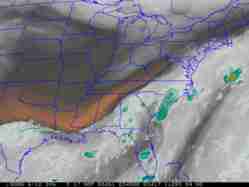
Western U.S. Satellite Imagery
| For a 1 or 2 km city-centered image, select which type of image you would
like and click on the map. Use the table below for all other views. All images will open in a new
window. |
|
|
 |
Here is a list of good weather satellite tutorials.
Animation and Java Trouble Shooting
In general, colors related to temperature,
warm-->cold is:
dark gray-->light gray-->yellow-->red-->bue
The brighter the color, the colder temperatures are.
|
Satellite Image Library
WESTERN U.S.
EASTERN U.S.
WESTERN ATLANTIC
SOUTHWEST U.S.
NORTHWEST U.S.
EASTERN PACIFIC
OTHER EASTERN PACIFIC/WESTERN U.S. IMAGES
ALASKA
HAWAII
CENTRAL PLAINS
NATIONAL GOES SERVER
GOES HIGH DENSITY WINDS
ARCHIVED SATELLITE DATA
RAMSDIS
Online is an online satellite looper. These loops consist
of 480x640 pixel-sized GIF images, each of which are about 200 KB.
Each of the animation loops contain between 8 and 24 images. So trying
to view the loops with a slow connection will take some time. However,
if you have the patience you can view nice satellite loops.
For more information, there is also a GOES
overview as well as GOES
News.
|
A vast majority of the satellite pictures you will
ever see come from GOES satellites (pictured above). GOES stands
for Geostationary Orbiting Environmental Satellite.
Currently there are two GOES satellites in operation: GOES 12
covers the Western Atlantic and eastern half of North America and
GOES 10 provides pictures for the eastern Pacific and western
half of North America. These instruments can provide much more information
with much better resolution than earlier GOES satellites as evident
by some of the links below. Below are views over the earth ranging
from the 1 km visible image over Central California to full disk views.
|
|
|
|
Webmaster
US Dept of Commerce
National Oceanic and Atmospheric Administration
National Weather Service
San Joaquin Valley Weather Forecast Office
900 Foggy Bottom Road
Hanford, CA 93230-5236
Tel: (559) 584-3752
|
Disclaimer
Information Quality
Credits
Glossary |
Privacy Policy
Freedom of Information Act
About Us
Career Opportunities
|
National Weather Service Mission: "The
National Weather Service (NWS) provides weather,
hydrologic, and climate forecasts and warnings for
the United States, its territories, adjacent waters
and ocean areas, for the protection of life and
property and the enhancement of the national economy.
NWS data and products form a national information
database and infrastructure which can be used by
other governmental agencies, the private sector,
the public, and the global community." |
|
|