
|
||
Natural Hazards >> Fires >> Fires in California
| ||||
|
Fires in California
Since the first weekend of summer 2008, California has been plagued by dozens of forest fires that were triggered by “dry” thunderstorms—thunderstorms that produce lightning, gusty winds, but little rain. As of the third week of July, several of the fires were tens of thousands of acres and still only partially contained. This image of Northern California shows the fires on Friday, July 18, 2008. The image was captured by the Moderate Resolution Imaging Spectroradiometer (MODIS) on NASA’s Terra satellite. Places where MODIS detected actively burning fires are outlined in red. Several of the fire complexes in Northern California affected more than 50,000 acres as of July 21, according to reports from the National Interagency Fire Center. The Iron/Alps Complexes were 57,154 acres, having grown 1,609 acres in the previous 24 hours. The nearby Lime Complex was 92,867 acres, having grown 3,044 acres in the previous 24 hours. In Southern California (pictured in the large image), the Basin Complex was still burning near Big Sur. That fire merged with the Indians Fire to the east, and their combined acreage was more than 134,000. The high-resolution image provided above is at MODIS’ maximum spatial resolution (level of detail) of 250 meters per pixel. The MODIS Rapid Response Team provides twice-daily images of Northern and Southern California in additional resolutions and formats, including an infrared-enhanced version that highlights burned ground. NASA image courtesy Jeff Schmaltz, MODIS Rapid Response Team. Caption by Rebecca Lindsey. Recommend this Image to a Friend Fires: Topic Home | Archive | Related Links Natural Hazards Home | Section FAQ |
Where in the World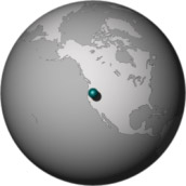
Image Posted July 21, 2008 Satellite & Sensor Aqua- MODIS Other Images for this Event Posted: Aug 15, 2008 Posted: Aug 11, 2008 Posted: Aug 04, 2008 Posted: Jul 29, 2008 Posted: Jul 25, 2008 Posted: Jul 23, 2008 Posted: Jul 16, 2008 Posted: Jul 15, 2008 Posted: Jul 14, 2008 Posted: Jul 14, 2008 Posted: Jul 11, 2008 Posted: Jul 10, 2008 Posted: Jul 10, 2008 Posted: Jul 10, 2008 Posted: Jul 08, 2008 Posted: Jul 08, 2008 Posted: Jul 07, 2008 Posted: Jul 03, 2008 Posted: Jul 02, 2008 Posted: Jul 01, 2008 Posted: Jun 30, 2008 Posted: Jun 27, 2008 Posted: Jun 26, 2008 Posted: Jun 25, 2008 Posted: Jun 24, 2008 Posted: Jun 23, 2008 Fires Latest Events Fires in Oregon and Northern California Fire in the Kalahari Fires in Mozambique, Zimbabwe, and South Africa Fires in Central South America Fires in Idaho Bushfires in Northern Territory, Australia | |||
|
Subscribe to Natural Hazards
About the Earth Observatory & Natural Hazards Contact Us Privacy Policy and Important Notices Responsible NASA Official: Lorraine A. Remer Webmaster: Goran Halusa We're a part of the Science Mission Directorate |
 Click here to view high-resolution version