ulf of Mexico
Archaeological Information
 Why
are archaeological resources a consideration in oil and gas exploration and development?
Why
are archaeological resources a consideration in oil and gas exploration and development?
The National Historic Preservation Act
(NHPA) of 1966, as amended, is Federal legislation developed to ensure that our
Nation’s historical and archaeological properties are not lost through neglect or
inadvertently damaged by activities permitted or funded by Federal agencies.
Specifically, MMS, as a Federal bureau, is required to ensure that activities it funds
(e.g., environmental studies) and activities it permits, such as lease sales, the drilling
of oil and gas wells, and the construction of pipelines, do not
adversely affect significant
archaeological sites on the Federal Outer Continental Shelf (OCS).
To determine if there
is a potential to affect archaeological resources on the OCS by proposed oil and gas
activities, the MMS Gulf of Mexico Region (GOMR) has funded archaeology studies
to ascertain where on the OCS these sites are likely to occur.
Archaeological sites on the OCS are most likely to be either prehistoric Native
American sites dating from the time at the end of the last Ice Age, when sea levels were
about 200 feet lower then they are today, or historic
shipwrecks. In areas where
archaeological sites are likely to be found the oil and gas industry is required to conduct surveys of the
seafloor using remote-sensing instruments. These instruments usually include a magnetometer, which detects ferrous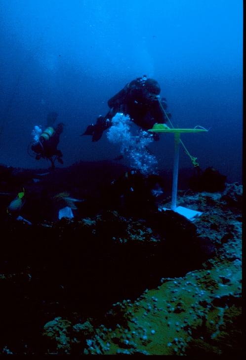 metals, a
sidescan sonar, which creates a picture of the seafloor using reflected sound waves, and
a subbottom profiler, which detects variations in the sediment underlying the seafloor.
The data collected by these instruments are reviewed by archaeologists, who write reports
on their findings for submittal to MMS. MMS archaeologists, in turn, use these reports
to review applications from industry to drill wells or construct pipelines.
metals, a
sidescan sonar, which creates a picture of the seafloor using reflected sound waves, and
a subbottom profiler, which detects variations in the sediment underlying the seafloor.
The data collected by these instruments are reviewed by archaeologists, who write reports
on their findings for submittal to MMS. MMS archaeologists, in turn, use these reports
to review applications from industry to drill wells or construct pipelines.
The MMS has specific guidelines contained in
NTL
2005-G07
for conducting remote-sensing surveys and
writing reports for archaeological sites on the OCS. These
guidelines only apply to
specific high-probability areas, and the requirements differ depending upon whether the
block has been determined to have a probability for historic shipwrecks or for submerged
prehistoric sites. To find out what the archaeology survey requirements are for a specific
block, go to Archaeology Survey Blocks.
This list is updated as new discoveries are made (last updated
March 16, 2006).
On occasion, the Gulf of Mexico Region needs more information about a particular
remote-sensing target to determine if it is a significant archaeological site and will
require the oil and gas industry to conduct an investigation by underwater archaeologists.
These investigations involve the use of divers
or remote operated vehicles (ROVs) and require that specific methodological guidelines are followed
(see links below).
Documents that have this symbol
 are in Adobe Acrobat's pdf format.
These files can be down loaded, read, and printed using the free Acrobat Reader
Archaeology Regulatory Links:
Archaeological Resources Regulation
Archaeology Survey Blocks
 (Updated
March 16, 2006)
(Updated
March 16, 2006)
NTL
2006-G07, Revisions to the List of OCS Lease Blocks Requiring Archaeological
Resource Surveys and Reports
NTL
2005-G07, Archaeological Resource Surveys and Reports
Diver Evaluation of Unidentified Magnetic Anomalies and/or
Sidescan Sonar Targets
Remotely
Operated Vehicle (ROV) Investigations of Unidentified Magnetic Anomalies and/or
Sidescan Sonar Targets: Methodological
Guidelines
Archaeology Frequently Asked Questions (FAQ)
Archaeology Publications:
Archaeology Studies - Completed Studies
Archaeology Studies - Ongoing Studies
Archaeology Papers
Archaeology Outreach:
Secrets of Historic
Shipwreck Intrigue MMS Archaeologists
Historic Shipwrecks in the Gulf of Mexico
(Updated
December 14, 2001)
Historic
Shipwrecks of the Gulf of Mexico, A Teacher's Resource