USGS Ohio Water Science Center
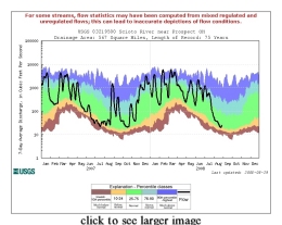
Of Current Interest... How Dry Is It?09/05/2008 --Exactly how dry (or wet) has it been lately? To help answer that question, duration hydrographs have been added as a new option under the drought watch pick list on the USGS WaterWatch Web page for Ohio. You can input a stream name or gaging station number and also select a 7-, 14-, or 28-day averaging period. An example for a streamflow gaging station (the Scioto River at Prospect, Ohio) is shown here. The plot shows a trace of the running 7-day average streamflow (the black line beginning on January 1 of the previous calendar year) as well as colored bands that represent historical percentile ranges of streamflow for each calendar day. (more). Is It Safe to Swim at the Beach?06/12/2008 --Concern about water quality at recreational beaches along the Great Lakes is the focus of a new collaborative project aimed at improving information for beach managers faced with deciding whether to close beaches or issue advisories to protect public health. USGS scientists will focus on real-time assessments of water quality--such as the Nowcast system used at two Ohio Lake Erie beaches--by enhancing and expanding models that help beach managers decide if beach advisories or closures are necessary. They will continue to evaluate rapid analytical methods for bacterial indicators, such as E. coli, and identify processes that influence the occurrence and abundance of pathogens and bacterial indicators at beaches. This project is funded through the President's Ocean Action Plan and draws on the expertise of the USGS and other federal, state and local agencies. (more). How Much Water is Consumed?05/22/2008 -- Ever wonder how much water is withdrawn for everyday uses such as food, ethanol, household chemicals, or paper products and is not returned? Or what type of uses are most likely to cause these losses? Information about consumptive water use (see images for examples) in the Great Lakes Basin can be found in a newly released fact sheet and report. Ohio Water Science Center hydrologists Kim Shaffer and Donna Runkle compiled and analyzed consumptive water use numbers from more than 100 sources to help determine the amount of water consumed in seven water-use categories. The fact sheet and report are among a series of products by the U.S. Geological Survey's National Assessment of Water Availability and Use Program for the Great Lakes Basin, a program designed to gain a clearer understanding of water-use, land-use, and climatic trends in our Nation’s water resources. (more). |
Location
Field Office: USGS Employee Directory Ohio WSC Brochures Water Resources Programs in Ohio
USGS Random Photo
Questions?
|