Event CategoriesYear 2008 Storm Events
Year 2007 Storm Events
Year 2006 Storm Events
Year 2005 Storm Events
Year 2004 Storm Events
Year 2003 Storm Events
Year 2002 Storm Events
Year 2001 Storm Events
Year 2000 Storm Events
Archival Imagery
2008 Regional Imagery
2007 Regional Imagery
2006 Regional Imagery
2005 Regional Imagery
2004 Regional Imagery
2003 Regional Imagery
2002 Regional Imagery
2001 Regional Imagery
2001 Regional Analyses
2000 Regional Imagery
2000 Regional Analyses
1999 Tropical Storm Summary
Home
NOAA Satellite and Information Service Home Page NOAA's All Hazards Monitor Where in the World is Tomorrow Now? NOAA National Hurricane Center NOAA Satellite Services Division Geostationary Satellite Server nowCOAST GIS Mapping Portal to Real-Time Environmental Observations and NOAA Forecasts Operational Significant Event Imagery Defense Meteorological Satellite Program NCDC Climate of 2008 FAQ: Hurricanes, Typhoons And Tropical Cyclones Visualization Lab Support | Year 2002 Storm EventsTropical Depression KyleTropical Depression Kyle regional imagery, 2002.10.10 at 1215Z. Centerpoint Latitude: 28:05:11N Longitude: 77:24:49W.
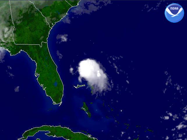
View our smaller 640 X 480
picture!Data Elements: A 1500Z report from http://www.nhc.noaa.gov says that Tropical Depression Kyle is moving west at 10 knots. Winds are sustained at 25 knots, with gusts up to 35 knots.
Observation Device: GOES-8 4 km infrared imagery.
Visualization Date: October 10, 2002 10:43:13
|