Weather: CloudSat and CALIPSO Help the Study of Meteorology
|
The study of meteorology presents significant challenges to scientists. One of the most challenging aspects is the inherent complexity of weather coupled with its high rate of change. In the case of clouds, scientists seek new insights into how they form, behave, and interact with the Earth's atmosphere. Engineers designed Cloudsat and Calipso to deliver the data needed by scientists to provide new understanding of how clouds, water vapor, ice particles, and aerosols affect the weather.
|
|
|
|
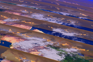
This animation visually describes how CloudSat and CALIPSO data slices can augment the study of meteorology.
Duration: 23.0 seconds
Available formats:
320x240 (29.97 fps)
MPEG-1
3 MB
720x486
Frames
320x240
PNG
81 KB
160x80
PNG
17 KB
80x40
PNG
5 KB
720x480 (29.97 fps)
MPEG-2
18 MB
640x480 (29.97 fps)
MPEG-4
8 MB
320x240 (29.97 fps)
X-FLV
772 KB
How to play our movies
|
|
|
|
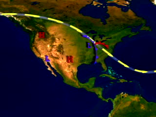
This print resolution still shows a typical weather map of the United States.
Available formats:
3000 x 2025
TIFF
19 MB
320 x 216
PNG
124 KB
|
|
|
|
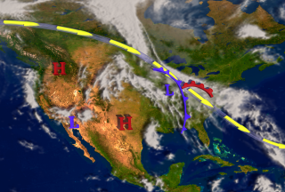
This print resolution still illustrates the build up of data swathes over the United States.
Available formats:
3000 x 2025
TIFF
19 MB
320 x 216
PNG
129 KB
|
|
|
|
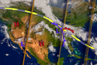
This print resolution still illustrates the build up of data swathes in conjunction with cloud cover.
Available formats:
3000 x 2025
TIFF
18 MB
320 x 216
PNG
110 KB
|
|
|
Back to Top
|

