Flood Briefing

Low Water Crossing Locations - Turn Around Don't Drown

 
Watch Warning Map
 Watch, Warning, Advisory Map
   

River Stages & Forecast Observed Rainfall
   
Rainfall Forecast
Precipitation Forecast Map
Day 1 | Day 2 | Day 3 | 5 Day Total
Excessive Rainfall
excessive rainfall outlook

Day 1 Flood Outlook
Spotter Outlook


  Weather Story Graphic

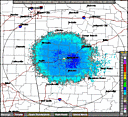
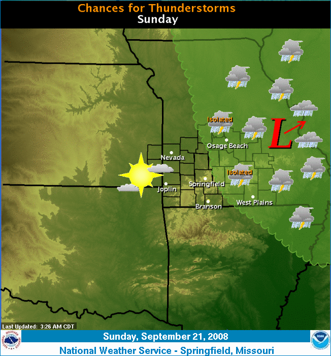
An upper level low will gradually track northeast. Isolated to scattered thunderstorms will be possible, primarily this afternoon east of Missouri Highway 5.


Short Term Graphical Forecast
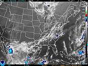
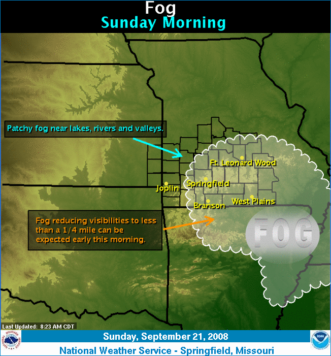
Fog will reduce visibilities across portions of the Missouri Ozarks through mid morning. Those traveling, particularly during the early morning hours, should be alert for drastic changes in visibility.


Radar
Local Radar
Reflectivity
| One Hour | Storm Total

Satellite
Infared Satellite
 Visible | IR | WV
Surface Analysis
Surface Analysis
Mesoscale Discussions
Storm Reports
SPC Storm Reports

Sector Analysis
SPC Hourly Mesoscale Analyses


  • NOAA's National Weather Service
  • Springfield, MO Weather Forecast Office
  • Springfield-Branson Regional Airport
  • 5805 West Highway EE
  • Springfield, MO 65802-8430
  • 417-863-8028
  • Page Author: SGF Webmaster
  • Web Master's E-mail: w-sgf.webmaster@noaa.gov
  • Page last modified: September 13th 2008 3:32 AM
USA.gov is the U.S. government's official web portal to all federal, state and local government web resources and services.