Overview
ERS has been a source of major land
use estimates in the United States for over 50 years, and the related U.S. cropland
used for crops series dates back to 1910. The Major Land Uses (MLU)
series is the only consistent accounting of all major uses of public and private
land in the United States. The consistent series was started in 1945, and
has since been published about every 5 years, coinciding with the Census of
Agriculture. The MLU series contains acreage estimates of major uses by region
and States for each census of agriculture year from 1945 through 2002.
Data from all 14 Major Land Uses reports have been combined into a
set of files showing major land uses from 1945 to 2002. Gaps in continuity
(identified as "Not Available")
occur only in categories with no data on which to base an estimate. This
is the case in Alaska and Hawaii prior to statehood in 1959. Since Alaska
contains such vast acreage, 50-State totals in all categories prior to 1959
may appear to change precipitously.
Features
U.S. Cropland Used For Crops—Cropland
harvested, failure, and summer fallow for the 48 states, annual, 1910-2006.
The series was updated December 2007.
Major Uses of Land in the United States, 2002—As
the latest in the Major Land Use series, which started in 1945, this
report summarizes cropland, forest, pasture and range, and miscellaneous
and special uses such as urban, recreational, and parkland. The annual
cropland portion of the series has been consistently maintained since 1910. Summary
tables are also available.
Land Use, Chapter 1.1 in Agricultural Resources
and Environmental Indicators—A summary and analysis of Major Land Uses
data can be found in this report, along with other data on land-use issues and
trends.
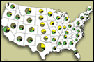
A
map summarizes major land uses of the 48 States for 2002.
Data Files
Data are available in three presentations:
- Summary tables—A
set of summary tables contain regional and State land-use data primarily
for 2002, but also provide historical data on urban area and irrigated
land in farms. These tables are available in PDF
format, or in Excel.
- Major Land Uses data series (see below)—The complete set of 16 spreadsheet
files cover acreage estimates
of major uses by region and States for each census of agriculture year
from 1945 through 2002.
File names are listed and described below. Those files
whose names are composed of lower case letters are subsets or components
of files with names entirely composed of capital letters (that is, CROPLAND
= cropland used for crops + cropland used for pasture + cropland idled).
The tables in each file are self-documenting and each file contains the
data name in cell A1.
| Table and description |
Excel format |
Lotus format |
| TOTAL LAND (The sum of CROPLAND, PASTURE, FOREST-USE LAND,
SPECIAL USES, and OTHER LAND) |
totaland.xls |
totaland.wk1 |
| |
CROPLAND: The sum of
cropland used for crops, cropland idled, and cropland used
for pasture |
cropland.xls |
cropland.wk1 |
| |
|
Cropland used
for crops: cropland harvested, crop failure, and cultivated summer
fallow. |
crops.xls |
crops.wk1 |
| |
|
Cropland used
for pasture: land rotated between crop and pasture use or marginal cropland
indefinitely used as pasture. |
croppast.xls |
croppast.wk1 |
| |
|
Cropland
idled: land completely
idled and lands seeded to soil improvement crops but not harvested or pastured. |
idle.xls |
idle.wk1 |
| |
PASTURE—Grassland
pasture and range: grassland and other nonforested pasture and range in
farms plus estimates of open or nonforested grazing lands not in farms.
Does not include cropland used for pasture or forest land grazed. |
pasture.xls |
pasture.wk1 |
| |
FOREST—Total forest-use
land: forest-use land grazed and forest-use land not grazed. |
forest.xls |
forest.wk1 |
| |
|
Forest-use land
grazed: woodland grazed in farms plus estimates of forested grazing land
not in farms. |
grzdfrst.xls |
grzdfrst.wk1 |
| |
|
Forest-use land not
grazed: total forest-use land minus forest-use land grazed. |
notgrazd.xls |
notgrazd.wk1 |
| |
SPECIAL—Total special uses: urban,
rural transportation, rural parks and wildlife, defense and industrial,
plus miscellaneous farm and other special uses. |
special.xls |
special.wk1 |
| |
|
Urban area: Densely-populated areas with at least 50,000 people
("urbanized areas") and densely-populated areas with 2,500 to 50,000 people
("urban clusters"). |
urban.xls |
urban.wk1 |
| |
|
Rural transportation: highways, roads, and railroad rights-of-way,
plus airport facilities. |
rrltrans.xls |
rrltrans.wk1 |
| |
|
Rural parks and wildlife areas: Federal and State parks,
wilderness areas, and wildlife refuges. |
parkwild.xls |
parkwild.wk1 |
| |
|
Defense and industrial areas.
|
defense.xls |
defense.wk1 |
| |
|
Farmsteads, farm roads, and lanes plus other miscellaneous
farmland. |
miscfarm.xls |
miscfarm.wk1 |
| |
OTHER LAND—All other
land uses: unclassified uses such as marshes, swamps, bare rock, deserts,
tundra plus other uses not estimated, classified, or inventoried. |
othrland.xls |
othrland.wk1 |
Sources
For citations for previous MLU reports and sources for the 2002 data update, see
specific bibliography and reference citations.
Glossary
More detailed definitions of major land uses and terms.
|