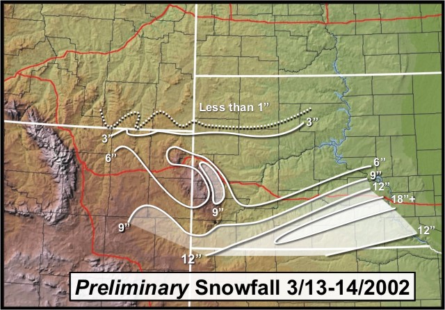
March 13-14, 2002 Snowstorm
A snowstorm developed over the southern Rockies on Tuesday, March 12th, 2002. It moved through Nebraska and into the upper Midwest by Thursday, March 14th, 2002. Snow started falling on northeastern Wyoming and southwestern South Dakota early Wednesday morning. Not much accumulation was noted during the day, except in the southern Black Hills and far southwestern South Dakota, including Hot Spring, Edgemont and Pine Ridge. Up to 5 inches fell during the day.
Wednesday night, the storm began to take shape and a steady snow develop over most areas along and south of Interstate 90. By Thursday afternoon, snowfall amounts ranged from just a skiff in in Buffalo, SD to 18 inches at the La Creek Wildlife Refuge.
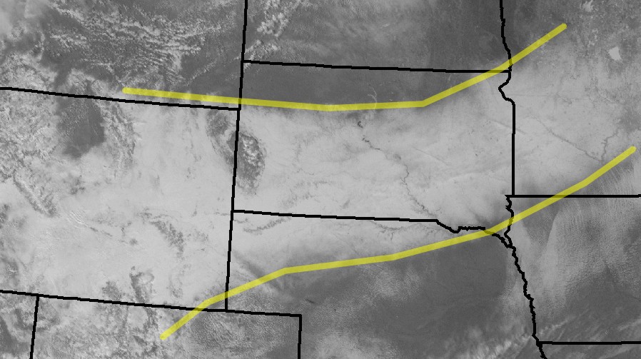
The day after the event (March 15, 2002), we saved a copy of the visible satellite image of the snowfield. You can see how extensive the snow was. The snowfield stretched all the way from Wyoming through Minnesota. The yellow lines depict the area of snow. Click here for an image with cities marked on it.