home » about nssl » research divisions » radar r&d » real-time applications & display development
The RADD group is a team of software engineers and computer scientists whose mission is to enable the research and development of applications and displays that improve the warning decision-making process. The Warning Decision Support System – Integrated Information (WDSS-II) has been developed by RADD along with its partners within and outside NSSL to achieve this mission.
WDSS-II
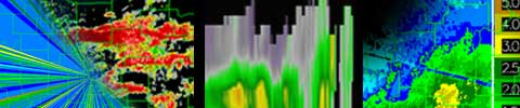
WDSS-II is the second generation of a system of tools for analyzing and visualizing remotely sensed weather data from multiple radars and sensors in an automated manner, aiming to make the warning decision-making process more efficient and effective for forecasters. The WDSS-II system is primarily used for research, prototype application development, and application evaluation, but the system runs 24/7 to evaluate the performance and scalability of the system for operational uses.
WDSS-II and NEXRAD
Researching and prototyping new severe weather warning applications using WDSS-II multi-sensor technology will help fast-track improvements into operations and provide a robust decision support system for forecasters. The Real-time Applications and Display Development (RADD) group partners with the Severe Weather Warning Appplications and Technology Transfer (SWAT) group in NSSL's Warning Division to develop these applications.
WDSS-II and Other Radar Technology
PAR: WDSS-II is being used by NSSL's PAR (Phased Array Radar) for display and algorithm processing. With the PAR's adaptive scanning capabilities, it will revolutionize the way we look at radar data. The PAR multi-function capabilities could allow WDSS-II to plot and display aircraft for the FAA.
CASA: NSSL is participating in an NSF sponsored Engineering Research Center called the Center for Collaborative Adaptive Sensing of the Atmosphere (CASA) to explore sensing the lower atmosphere with a network of many small-wavelegnth radars spaced to overcome the Earth-curvature sampling issues that occur with current radars. CASA will employ a new observation methodology termed DCAS (Distributed Collaborative Adaptive Sensing networks), that will operate the network of radars collaboratively and adapt to changing atmospheric conditions and the needs of various end users. CASA radars will use WDSS-II to ingest and process data for detection algorithms. Smaller scales and more frequent updates may generate as many questions as answers: What precursors will we see? At what point does a funnel cloud become a tornado? Will CASA radars help confirm tornado touchdowns after dark and in remote areas where visual confirmation is difficult? Can we detect severe weather this close to the ground? What is the effect of attenuation on X-band radar data? How can a network of X-band radars be used to alleviate the problem?
SMART-R: The SMART-Radar’s are being tested with the WDSS-II display system such that they could be deployed, in the case of a catastrophic failure of a WSR-88D radar due to hurricanes or other phenomena, to support NWS operations.
