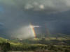
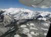
Double Rainbow
near Telluride, CO |

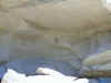
"Waving Hands"
Pictograph
ca 850-1100 AD
(Rio Blanco Co, CO) |
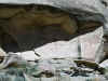
"The Guardian"
Pictograph
ca 1-500 AD
(Rio Blanco Co, CO) |
Kokopelli Pictograph
"Cañon Pintado"
ca 850-1100 AD
(Rio Blanco Co, CO) |

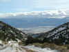
Western Rio Blanco County, CO |

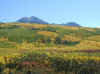
Trout Lake and Yellow Mountain
(San Miguel Co, CO) |

Lizard Head Peak
13,113'
(San Miguel Co, CO) |

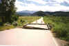
Dolores River near Rico, CO
(May 2001) |

Dallas Divide
Ouray Co, CO
(winter 2000) |

Dallas Divide
Ouray Co, CO
(spring 2001) |

1st Weather Office in Grand Junction
|
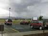
Current NWS Office in Grand Junction
(Walker Field) |

Silverton, CO
(Downtown) |
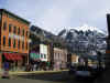
Telluride, CO
(Downtown) |

Chimney Rock
near Towoac, CO |
|

Idarado Mine
Ouray Co, CO
April 2001
|
 Sunset over Sunset over
Grand Junction
(Mongolian Dust)
April 16, 2001
|
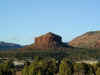
Cheese Box Butte
San Juan Co, Utah
March 2001
|
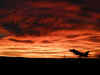
Sunset over
Grand Junction
March 31, 2001
|

Southeast Utah
March 2001
|
|

Southeast Utah
March 2001
|

Lime Creek Avalanche
Winter 2001
(next 3 images)
|

|
 |

Pagosa Springs
January 2001
|
|
Browns Park, CO
Winter 2000/01
|

Telluride, CO.
November 2000
|
McClure Pass
September 2000
|

West Elk Mountains
September 2000
|

Black Canyon of the Gunnison River
September 2000
|
|

Flash Flood Debris
Near Gateway, CO.
Summer 2000
|
2000 Forest Fires Montana
(Photo by John McClogan)
|
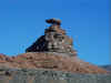
Mexican Hat, UT. Spring 2000
|
Hotchkiss, CO
Spring 2000
|

Avon, CO
Winter 1999
(Photo by Tom Macht)
|
|

Wildfires west of Grand Junction
July 1999
|
Dallas Creek
Flash Flood
Ouray Co, CO
July 1999
|

Near El Jebel, CO May 1999
|

Sunset over Grand Junction, CO. 1999
|

Castle Valley, Utah
Summer 2000
|
|

Bonham Reservoir, Grand Mesa, CO
Fall 1999
|

Escalante, CO Summer 1999
|
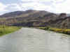
Gunnison River near Escalante, CO
Summer 1999
|

Gunnison River near Escalante, CO
Summer 1999
|

Sunset over Grand Junction, CO
1999
|
|
Severe Thunderstorm approaching Grand Junction
|
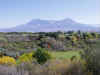
San Juan Mountains
April 2000
|

Mount Garfield, Grand Junction, CO Winter 1999
|
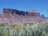
"The Palisade" near Gateway, CO
Fall 1999
|

Near Pea Green, CO. 1999
|
|

Rainbow over the Bookcliffs, north of Grand Junction
|

Cirrus Clouds over the San Juan Mountains
November 2000
(Photo by Steve Dalman)
|

Uncompahgre Peak
Summer 2000
|

Lowering of the Dome on the KGJX WSR-88D Doppler Radar
Summer 1995
|

Aurora Borealis from Grand Junction, CO. (Photo by David Copley)
|


