- NASA Home
- | Centers
- | Goddard Home
- | News
- | Top Story
- | 2006
Multimedia
Earth Science Resource Reel - 2005
04.17.06
GSFC Library #: G06-004
Center Contact: Rani Chohan: 301-286-2483
|
|
+ Click here for ordering information.
 Click on image to view animation. |
Tour of the Cryosphere It’s often said that Earth is a water planet. More than 70 percent of the surface is awash in liquid water. But vast frozen zones found at the poles, in glaciers, and in seasonal deposits of snow also play profound roles in the Earth’s natural behavior. In this narrated tour of the Cryosphere, satellite data reveals important features of a changing world. Credit: NASA + Click here for additional information. |
 Click on image to view animation. |
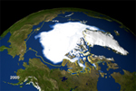
2005 Arctic Sea Ice Decline Researchers from NASA, the National Snow and Ice Data Center and others using satellite data have detected a significant loss in Arctic sea ice this year. On September 21, 2005, sea ice extent dropped to 2.05 million sq. miles, the lowest extent yet recorded in the satellite record. Incorporating the 2005 minimum using satellite data going back to 1978, with a projection for ice growth in the last few days of this September, brings the estimated decline in Arctic sea ice to 8.5 percent per decade over the 27 year satellite record. Credit: NASA + Click here for additional information. |
 Click on image to view animation. |
Waterline: Breakthrough Discoveries in Sea Level Change Research Some questions defy easy answers. Take measurements of global sea level for example. As a concept, issues relating to sea level are easy to grasp; everyone understands what a rising or falling waterline means in any basin, from a swimming pool to a lake to a glass of water. What's harder to grasp is a thorough understanding of the processes that may affect changing sea levels, and the implications of those changes on a planetary scale. From issues of temperature variations around the poles, to salinity changes in the deep seas, to elastic land surfaces changing the shape of the planet itself, sea level describes a series of conditions that are all related. Credit: NASA + Click here for additional information. |
 Click on image to view animation. |
Black Soot May Cause Changes in the Arctic New findings from NASA computer models show that soot, or black carbon, found in the Arctic may be derived from far-away South Asia. Once there, it may be contributing to changes happening at the North Pole, such as accelerated melting of sea ice and snow and changing atmospheric temperatures. Credit: NASA + Click here for additional information. |
 Click on image to view animation. |
Earth's Energy Out of Balance Scientists using satellites and computer models to study the Earth's oceans have concluded that more energy is being absorbed from the Sun than is reflected back to space, throwing the Earth's energy "out of balance" and warming the globe. Credit: NASA + Click here for additional information. |
 Click on image to view animation. |
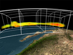
NASA/NOAA Announce Major Weather Forecasting Advancement The Atmospheric Infrared Sounder instrument on NASA’s Aqua spacecraft provides 3-D data on temperatures, humidity and trace gases for use in weather forecasting models. Incorporating the instrument's data into the National Oceanic and Atmospheric Administration’s National Weather Service forecasts has improved the accuracy of medium-range weather forecasts in the Northern Hemisphere by four percent. That type of improvement typically takes several years. Credit: NASA + Click here for additional information. |
 Click on image to view animation. |
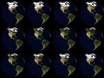
NASA Takes the Blue Marble to the Next Generation NASA operates 18 of the most advanced Earth-observing satellites ever built, which help scientists make some of the most detailed observations ever made of our world. In 2005, NASA shared the newest in a series of images called The Blue Marble - Next Generation. This new Earth imagery enhances the Blue Marble legacy, captured during Apollo 17, by providing a detailed look at an entire year in the life of our planet. Credit: NASA + Click here for additional information. |
 Click on image to view animation. |
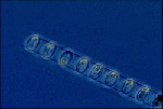
The Mathematical Ocean: Deriving Planetary Health from Tiny Ocean Plants Most life in the ocean does not have fins or flippers. Single celled organisms called phytoplankton far outnumber the sum of all the marine organisms most of us think of first. While phytoplankton individually are largely invisible to the naked eye, their total effects can be seen from space. There are many trillions of phytoplankton in the sea, and together they convert huge quantities of carbon dioxide (CO2) into living matter. In that process they release a major percentage of the world's oxygen into the atmosphere. These life processes help regulate the planet's overall climate and habitability and are a bellwether of planetary health. NASA research using satellite measurements of phytoplankton has opened the door to global observations of these tiny life forms as a group, essentially helping scientists put a finger on the living pulse of the oceans, the rhythm of life upon which we all depend. Credit: NASA + Click here for additional information. |
 Click on image to view animation. |
The Deep Blue Sea... Gets Greener There's more green in the ocean. Scientists, working with six years of NASA satellite data, have detected nearly a 10 percent increase in plankton concentrations near costal regions. The scientists also observed declines in plankton concentrations in mid-ocean. Phytoplankton is important because it comprises the foundation of the food chain. The scientists say more research is needed to determine why the concentrations of plankton are changing. Credit: NASA + Click here for additional information. |
 Click on image to view animation. |
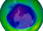
2005 Ozone Hole This year's Antarctic ozone hole is the fifth largest ever observed. The Antarctic ozone "hole" is defined as thinning of the ozone layer over the continent to levels significantly below pre-1979 levels. Each year the 'hole' expands over Antarctica, sometimes reaching populated areas of South America. Ozone blocks harmful ultraviolet radiation, which has been linked to skin cancer in humans and other adverse biological effects in plants and animals. Human-produced chlorine and bromine chemicals primarily cause the ozone hole, but extremely cold temperatures near the edge of Antarctica are also key factors in ozone loss. Credit: NASA + Click here for additional information. |
 Click on image to visit website. |
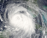
Hurricane Resource Page Please refer to the 2005 Hurricane Resource Page for a full overview of the 2005 Hurricane Season. Credit: NASA + Click here for additional information. |
 Click on image to view animation. |
Named Storms in 2005 This visualization shows all 23 named storms during the 2005 Atlantic hurricane season, from Arlene to Beta. Orange and red colors represent ocean temperatures at 82 degrees F or higher - the temperature required for hurricanes to form. Temperature data is from the AMSR-E instrument on the Aqua satellite, while the cloud images were taken by the Imager on the GOES-12 satellite. Credit: NASA + Click here for additional information. |
 Hurricane Datasets See Hurricanes covered from every angle in the sky. NASA's Tropical Rainfall Measuring Mission (TRMM) satellite observed the distribution of rainfall inside Hurricane Katrina, satellite cloud data was obtained from NOAA/GOES and images from the Moderate Resolution Imaging Spectroradiometer (MODIS) instrument on NASA's Terra and Aqua satellites reveal the vast expanse of Hurricane Katrina as it stretched clear from the Gulf Coast to Ohio. Credit: NASA + Click here for additional information. |
|
 Click on image to view animation. |
NASA, NOAA & Aerosonde Team on Hurricane Observation Milestone NASA, NOAA and Aerosonde North America teamed up to mark a new milestone in hurricane observation on Sept.16 as an unmanned aircraft flew into Hurricane Ophelia. The aircraft, known as an Aerosonde, provided the first ever detailed observations of the near-surface, high wind hurricane environment, an area often too dangerous for manned aircraft to observe directly. Credit: NASA/NOAA + Click here for additional information. |
 Click on image to view animation. |
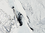
Giant Iceberg Breaks Up NASA satellites show the 1,200-square-mile B-15A iceberg breaking up into three huge pieces. For the last several years, this iceberg has earned the title of the largest free-floating object on the planet. In 2003 and 2004, it was stuck near Ross Island, the location of the U.S. Antarctic Program's McMurdo Research Station, trapping ice in McMurdo Sound. The excess ice stranded penguins, who could not reach open water and return with food for their young, and made planning a shipping route to McMurdo Station difficult. B-15A is now near Cape Adare. Credit: NASA + Click here for additional information. |
 Click on image to view higher resolution. |
NASA Technology and EPA Team to Improve Crop Monitoring Can you see the difference between traditional corn and bio-engineered corn -- where genes have been inserted to make the plant resistant to insects? NASA technology is beginning to provide the answer in a snapshot. The technology, called hyperspectral imaging, uses a special camera to cut one snapshot into 120 color-specific images. Hyperspectral means that you are getting many more images within the spectrum of just one picture. Each image shows a unique characteristic, not visible to the human eye. Credit: NASA + Click here for additional information. |
 Click on image to view higher resolution. |
Aura Validation Mission (AVE) Ellington Airfield, Houston, Texas. The WB-57 takes off from Ellington Field Houston conducting 3-week Aura Validation Experiments or AVE. AVE is a set of experiments to verify that the AURA spacecraft sends accurate and valuable information concerning the chemical makeup of the atmosphere. The WB-57F aircraft will be loaded with a suite of in situ and remote sensing instruments to collect data on atmospheric gases, such as ozone, methane, and water vapor, aerosols, and cloud physical properties. Goddard Scientists lead the three week field campaign. Credit: NASA/USGS + Click here for additional information. |
 Click on image to view animation. |
CloudSat and CALIPSO: Revealing the Secrets of Clouds and Aerosols The sky stretches above us like an endless canvas, but of its most familiar components, the clouds, we actually know very little. That's why NASA is sending two new satellites into space. Looking down from orbit, scientists can gather information about clouds, ice crystals, aerosols, and a range of related subjects. CloudSat will help precisely measure key elements of the water cycle, CALIPSO will pursue knowledge about short-term air quality and both missions address long-term climate issues. They're designed to do this as a matched pair, taking nearly simultaneous measurements of the same spot over Earth. Together, these satellites will help answer important questions about the nature of our planet. Credit: NASA + Click here for additional CALIPSO information. + Click here for addition CloudSat information. |
 |
NASA and NOAA Launches New Polar Orbiting Satellite (POES) A new POES satellite launched to help improve long-range climate forecasts and assist in U.S. search and rescue operations. Called NOAA-N, it will also be a key to establishing a strong Global Earth Observation System of Systems (GEOSS), by helping strengthen global understanding of the environment. Credit: NASA/NOAA + Click here for additional information. |
 Click on image to view animation. |
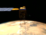
NASA's Earth Observing Fleet NASA's Earth Observing fleet continues to grow and represents a major milestone in the history of earth science. The satellites’ remote-sensing capabilities have facilitated all kinds of wide-scale and synergistic research endeavors that until the last decade have been impossible to even consider. Credit: NASA + Click here for additional multimedia. |
 Click on image to view animation. |
A-Train Scheduled to launch in 2006, CALIPSO, a joint mission between the United States and France, and CloudSat, partnered with Canada, will join a group of satellites known as the "Afternoon Constellation," or "A-Train." By flying in close proximity, satellites in the A-Train combine to provide detailed observations of the earth system. Credit: NASA |