| ......MARINE WEATHER |
| National Marine Forecasts Page |
| ......COASTAL MARINE FORECASTS |
| Washington |
| Oregon Northern | Southern |
| California Northern | Central | Southern | Mexican Border | Offshore 60 to 250 nm |
| High Seas Forecast - Eastern Pacific |
San Francisco and Monterey Bay waters
|
| ......MAPS & GRAPHICS |
|
Morning Briefing for the Pacific - This briefing page is made by the Ocean Prediction Center and is meant for printing out the marine weather charts displayed so if you have a slow connection it will take some time to download. Using the print command you should be able to print all of the charts on separate 8.5 inches X 11 inch pages. The Pacific Briefing Package will have the 12Z 500 mb, 12Z surface analysis, 12Z or 15Z offshore & adjacent waters sea state analysis, 00Z 24 hour surface, 00Z 24 hour wind/wave, 00Z 48 hour 500 mb, 00Z 48 hour surface, 00Z 48 hour wind/wave, 12Z 96 hour 500 mb, 12Z 96 hour surface, and 12Z 96 hour wind/wave charts. |
| ......WAVE, SEA STATE, AND SATELLITE DATA |
|
| ......PACIFIC WAVE HEIGHT FORECASTS |
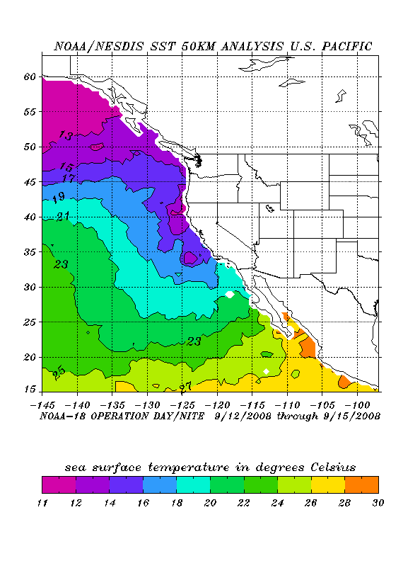
| ......SEA SURFACE TEMPERATURE ANALYSIS |
SST charts |
|
| ......TIDE TABLES / CURRENTS |
| ......LINKS TO OTHER MARINE SITES |
|
National Marine Sanctuaries
|