|
Weather Story NWS Bismarck, ND |
|
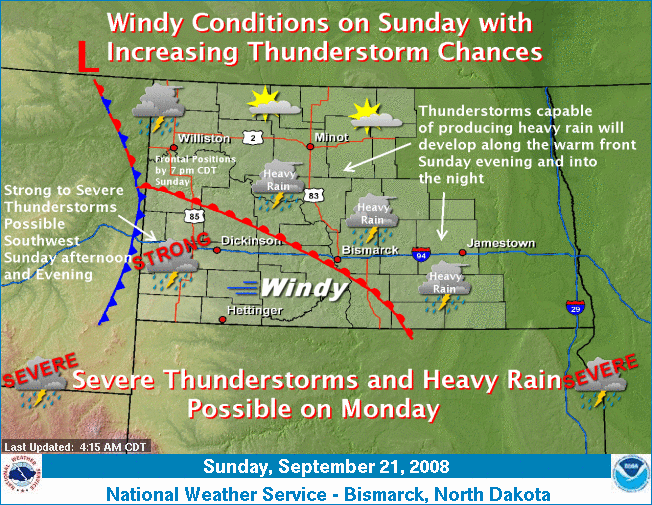
Scattered thunderstorms will develop in western North Dakota Sunday afternoon and into the evening ahead of a cold front. A few of these storms may become strong to severe with large hail, damaging winds and dangerous lightning. Additional thunderstorms capable of heavy rain will develop along the warm front into south central and southeastern North Dakota Sunday evening and into the overnight. Winds will increase into the afternoon across western and central North Dakota, becoming sustained from the southeast at 20 to 25 mph with gusts of 35 mph. The strongest winds will be seen in the south central and eastern portions of the state. The cold front and its associated strong upper level disturbance will enter central North Dakota by Monday evening. Severe thunderstorms and heavy rain will be possible on Monday, especially across central North Dakota.