Hurricane Katrina Rain Accumulation
|
This animation shows rain accumulation from Hurricane Katrina from August 23 through 30, 2005 based on data from the Tropical Rainfall Measuring Mission (TRMM) Multisatellite Precipitation Analysis. Satellite cloud data from NOAA/GOES is overlaid for context. The accumulation is shown in colors ranging from green (less than 30 mm of rain) through red (80 mm or more). The TRMM satellite, using the world's only spaceborne rain radar and other microwave instruments, measures rainfall over the ocean.
|
|

|
|
Hurricane Katrina rain accumulation (yellow/red trail shows rain)
Duration: 18.0 seconds
Available formats:
320x240 (30 fps)
MPEG-1
1 MB
640x480 (30 fps)
MPEG-1
6 MB
720x480 (29.97 fps)
MPEG-2
10 MB
320x240
JPEG
44 KB
1280x720 (29.97 fps)
MPEG-2
40 MB
1280x720 (30 fps)
Frames
720x486
Frames (Rain accum)
How to play our movies
|
|

|
|
Dates overlay (with alpha) corresponding to Hurricane Katrina rain accumulataion
Available formats:
720x486
Frames (Dates)
320x216
PNG
2 KB
How to play our movies
|
|

|
|
Hurricane Katrina rain accumulation for the period Aug 23 through 29
Available formats:
2560 x 1920
TIFF
15 MB
320 x 240
JPEG
74 KB
80 x 40
PNG
7 KB
160 x 80
PNG
28 KB
|
|
|
|
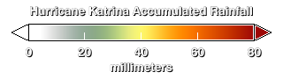
Rain accumulation color bar (green=20mm, yellow=40mm, orange=50mm, red=80mm+)
Available formats:
320 x 90
TIFF
8 KB
320 x 90
PNG
1 KB
|
|
|
Back to Top
|

