|
|
 |
Hurricane Bonnie from TRMM with Cloud Tower: August 22, 1998 (Long Version)
|
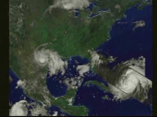
These compelling images are from Hurricane Bonnie showing a cumulonimbus storm cloud, towering like a sky scraper, 59,000 feet (18 kilometers) into the sky from the eyewall. Thes images were obtained on Saturday, 22 August 1998, by the world's first spaceboarne rain RADAR aboard the Tropical Rainfall Measuring Mission (TRMM), a joint U.S.-Japanese mission. Launched November 27, 1997, the TRMM spacecraft continues to provide exciting new insight into cloud systems over tropical oceans. By comparison, the highest mountain in the world, Mt. Everest, is 29,000 feet (9 kilometers) and the average commercial jet flies at barely one-half the height of Bonnie's cloud tops. Scientists believe that towering cloud structures like this are probably precursors to hurricane intensification. This was the situation with Bonnie whose central pressure dropped from 977 millibars to 957 millibars in the subsequent 24 hours. TRMM is a joint NASA and NASDA mission that was launched November 27, 1997 from the Japanese Space Center, Tanegashima, Japan.
|
|

|
|
This animation shows a fly-in to Hurricane Bonnie showing the three-dimensional structure of the precipitation as measured by the Precipitation Radar instrument on TRMM on August 22, 1998. In this animation, a surface of constant precipitation is colored by the value of the precipitation on the ground under the surface.
Duration: 53.0 seconds
Available formats:
1280x720 (30 fps)
Frames
1920x1080 (30 fps)
MPEG-2
115 MB
352x240 (29.97 fps)
MPEG-1
6 MB
160x80
PNG
19 KB
80x40
PNG
6 KB
320x238
JPEG
10 KB
How to play our movies
|
| Animation Number: | 222 |
| Animator: | Greg Shirah (SVS) (Lead) |
| Completed: | 1998-12-31 |
| Scientist: | Chris Kummerow (NASA/GSFC) |
| Instruments: | GOES
|
| | TRMM/PR |
| | TRMM/VIRS |
| Data Collected: | 1998/08/22 |
| Series: | TRMM 3D Hurricanes |
| Video: | SVS1998-0005 * |
Keywords:
DLESE
>> Atmospheric science
SVS
>> HDTV
SVS
>> Hurricane
DLESE
>> Natural hazards
|
|
Please give credit for this item to
NASA/Goddard Space Flight Center Scientific Visualization Studio |
*Please note: the SVS does not fulfill requests for copies of the tapes in our library. On some of our animation pages, there is a direct link to a video distribution service from which tapes, handled by the Public Affairs Office (PAO)/Goddard TV, including some of our animations may be ordered. General information on this service can be found here. |
|
Back to Top
|
|
|
|

