Tropical Depression Nine formed over the northwestern Gulf of Mexico from
the interaction of a persistent low-level trough and a cluster of
convection, associated with a tropical wave, that moved north-northwestward
from the Yucatan Peninsula. A poorly-defined low level center formed about
160 n mi south of Lake Charles, LA, on 8 September
(Table 1 and Figure 1).
Surface observations indicate the center moved north-northwestward and
crossed the Gulf coast near Sabine Pass, TX around 1000 UTC 9 September.
The cyclone dissipated over land later that day.
Squalls with gusts to tropical storm-force occurred well to the east of the
center. These produced a 39 kt gust at buoy 42001 at 2100 UTC 8 September,
a 35 kt gust at buoy 42041 at 2200 UTC that day, and a 34 kt gust at the
Southwest Pass C-MAN station at 2000 UTC that day. Rainfall associated with
the cyclone affected portions of Louisiana and Mississippi. There are no
reports of damage or casualties.
Table 1.
Best track, Tropical Depression Nine, 8 - 9 September 2000.
Date/Time
(UTC) | Position |
Pressure
(mb) |
Wind Speed
(kt) | Stage |
| Lat. (°N) | Lon. (°W) |
| 08 / 1800 | 27.5 | 93.5 | 1009 | 25 | tropical depression |
| 09 / 0000 | 28.5 | 93.5 | 1009 | 30 | " |
| 09 / 0600 | 29.3 | 93.8 | 1009 | 25 | " |
| 09 / 1200 | 30.0 | 94.0 | 1010 | 25 | " |
| 09 / 1800 | | dissipated |
| |
| 08 / 2100 | 28.0 | 93.5 | 1008 | 30 | minimum pressure |
| 09 / 1000 | 29.9 | 93.9 | 1009 | 25 | landfall near Sabine Pass, TX |
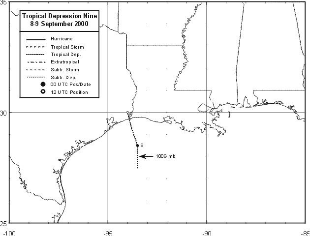
Figure 1.
Best track for Tropical Depression Nine, 8-9 September 2000.
![[NCEP Logo]](graphics/ncep.gif)
