

Images & Animations
-
Credit
<p>Image courtesy Jacques Descloitres, MODIS Land Rapid Response Team at NASA GSFC.<p>
Seasonal rains in Indochina from August into October 2002 gave rise to deadly floods across the peninsula
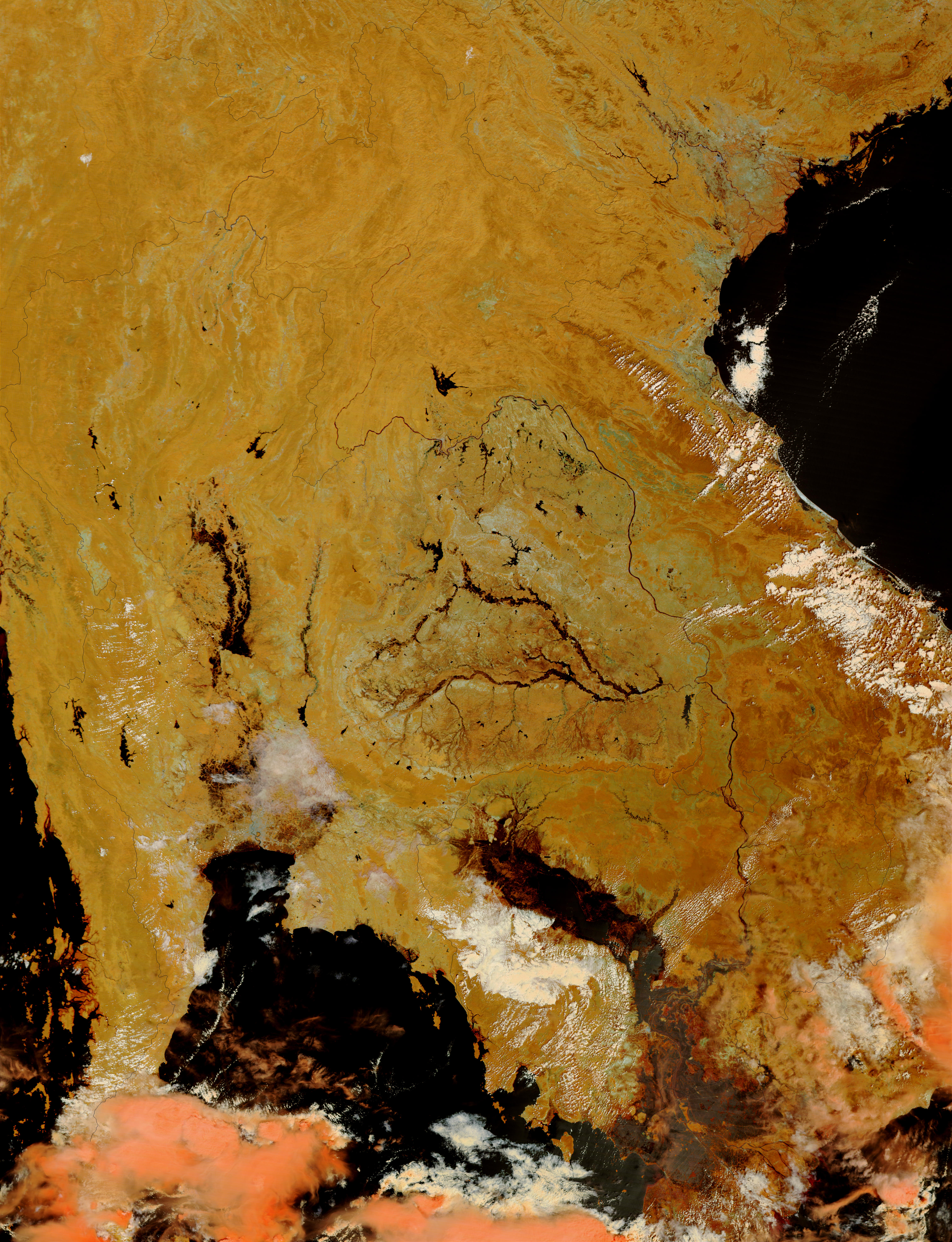
For two months, heavy, seasonal rains have inundated Thailand, flooding the countryside and killing over 120 people. This false-color image of Thailand was acquired on October 9, 2002, by the Moderate Resolution Imaging Spectroradiometer (MODIS) aboard NASA?s Terra spacecraft.
Thailand can be found just above the Gulf of Thailand, which is the body of water at the bottom of the image. The Chao Phraya River and the Yom River run down the center of the country into the gulf. Though the rivers now resemble narrow lakes in central Thailand, they normally would be faint in the image. In addition to the loss of life, 2.5 million people have suffered property damage or loss as a result of the floods. In many towns in central and northern Thailand people can only travel by boat, and many town centers have turned into floating markets.
In the large image, the entire Indochina Peninsula can be seen. Looking closely at the southeastern corner of the peninsula, mudflats and waterlogged farms can be seen emerging from abating floodwaters in Cambodia and Vietnam. Only a month ago these countries were experiencing some of the worst seasonal floods in years.
In this image, clouds are white and pink, water is black, and solid land is orange and brown.
Metadata
-
Sensor
ADEOS/ADEOS -
Start Date
2002-10-09 -
Event Start Date
2002-08-30 -
NH Image ID
5177 -
NH Event ID
4635 -
NH Posting Date
2002-10-10