UV
Index UV
Index
Four-day forecast map | Lookup
your index | Related
links
The ozone layer shields the Earth from harmful UV radiation. Ozone depletion,
as well as seasonal and weather variations, cause different amounts of
UV radiation to reach the Earth at any given time. Developed by the National
Weather Service (NWS) and EPA, the UV Index predicts the next day's ultraviolet
radiation levels on a 1-11+ scale, helping people determine appropriate
sun-protective behaviors. EPA will issue a UV Alert when
the level of solar UV radiation is predicted to be unusually high, and
consequently the risk of overexposure is greater.
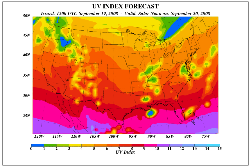
UV Index Forecast Map
The forecast map shows contour lines of predicted UV Index values during
the solar noon hour. The map is created
daily from National Weather Service forecast data. Click the buttons
for Day 2, Day 3, or Day 4 to see the UV Index forecast for following days. You
may notice a brief delay as each map loads. (To find the time of solar noon at your location, use the sunrise-sunset-solar noon calculator at the NOAA Web site.)
Find Today's UV Index For Your City/Town
The UV Index is calculated daily. Enter
your ZIP Code or city and state below for today's UV Index in your area. If a UV
Alert is in effect for your area, that information is included with
the UV Index.
You can also look up UV Index using the following resources.
- UV
Alert Map
 -
Areas in the U.S. where predicted UV intensity will be well above normal,
and you will need to be especially careful to avoid over-exposure. -
Areas in the U.S. where predicted UV intensity will be well above normal,
and you will need to be especially careful to avoid over-exposure.
- Cities Map - Forecast UV Index values
for 58 U.S. cities, shown on a map.
- Text
Bulletin -
A plain text listing of forecast UV Index values for 58 U.S. cities.
Related Information
To report UV measurements for your school, please see the SunWise data
entry page.
The following UV Index archives and other information are available from
National Weather Service:
Top of page
|