 |
||||
|
|
|
|||


|
|
Home > Research > Region > United States > Midwest
Research by Region: United States - Midwest
Illinois | Indiana | Michigan | Minnesota | Ohio | Wisconsin
GLERL research programs emphasize studies in the Great Lakes region. Below are descriptions of GLERL research programs that take place predominantly in Illinois or within Illinois nearshore waters. Additional projects that may affect Illinois, due to the interconnected nature of the ecosystem, are listed under our Great Lakes Drainage Basin section. This section includes the many GLERL research collaborations that are large scale, multi-institution projects which span large portions of the basin, including parts of Illinois.
Illinois |
|
|
Real-Time Meteorological Observation Network |
 |
Meteorological Observation Network's Chicago Station Web Cam |
 |
| Effects of non-indigenous invertebrates on the pelagic food web of Lake Michigan Our goal is to evaluate the status of the pelagic food web in Lake Michigan at sites where we also have access to historical data. This project encompasses four separate projects to help elicit the status and changes in the pelagic food web of Lake Michigan. + Read more |
 |
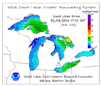
| Great Lakes Coastal Forecasting System |
 |
Lakes Michigan-Huron Daily Water Level Plot |
 |
| Illinois Precipitation Data Two types of downloadable files are available: P_*_DAT files contain the monthly precipitation data for Illinois station. *-HST files contain the station history information extracted from the WB 530-1 forms by the National Climatic Data Center (NCDC). These data show the station number, latitude, longitude, elevation, station name, and period of record for each station location. These are ZIPPED files, with one file for each state. + Access Data |
|
![]()
![]()
Last updated: 2008-06-05 mbl