
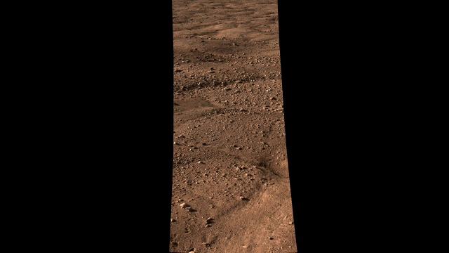
Click on the image for the animation
This movie shows the vast plains of the northern polar region of Mars, as
seen by NASA's Phoenix Mars Lander shortly after touching down on the Red
Planet. The flat landscape is strewn with tiny pebbles and shows polygonal
cracking, a pattern seen widely in Martian high latitudes and also
observed in permafrost terrains on Earth. The polygonal cracking is
believed to have resulted from seasonal contraction and expansion of surface
ice.
Phoenix touched down on Mars at 4:53 p.m. Pacific Time (7:53 p.m. Eastern
Time), May 25, 2008, in an arctic region called Vastitas Borealis, at 68
degrees north latitude, 234 degrees east longitude.
This is an approximate-color image taken by the spacecraft's Surface
Stereo Imager, inferred from two color filters, a violet, 450-nanometer
filter and an infrared, 750-nanometer filter.
The Phoenix Mission is led by the University of Arizona, Tucson, on behalf
of NASA. Project management of the mission is by NASA's Jet Propulsion
Laboratory, Pasadena, Calif. Spacecraft development is by Lockheed Martin
Space Systems, Denver.


