U.S. Geological Survey - science for a changing world - http://www.usgs.gov

        Click here to view
        Water Resources Data
        Mississippi
        Water Year 2007


    MS WSC FAQ's
    USGS News
    Employment
    Data
        Local and National
            Water Data
        Local Real-Time Data
        Coastal Water Quality
            & Meteorological Data
        Surface-Water Data
            and Maps
        Ground-Water Data
            and Maps
        Flood Tracking System
        Flood Tracking Chart
        Local Precipitation Data
        Decodes scripts
        Local Weather
    Publications
        Water Resources
        Educational Posters
        Applications Software
        Historical Publications
        Hurricane Camille Atlas
        Bridge Backwater Atlases
    Maps
        Interactive MS Map
        MS Highway Map*
        MS County Maps*
        MS City Maps*
        USGS National Mapping
        Aerial Photos
        Topographic Maps
        National Atlas
        FEMA Flood Maps
    GIS
        USGS GIS
        A Guide to GIS
        National Seamless Data
        MARIS Data Warehouse
        GIS Data for Water-
            Resources
        Geography Network
        www.GeoData.gov
    Projects
    Educational Links
        Water Science
            for Schools
        The Learning Web
        EPA's Surf Your
            Watershed
    USGS Links
        Dept. of the Interior
        U.S. Geological Survey
        Biological Resources
        Geological Resources
        National Mapping
        Water Resources


Click below
to download FREE
Adobe Acrobat Reader
software.

Download the free Adobe Acrobat Reader software


*All maps created
and distributed by
Mississippi Department
of Transportation


Mississippi Department of Transportation - www.gomdot.com


Welcome to the
U.S. Geological Survey
Mississippi Water Science Center

Homepage

Photo of the Mississippi Water Science Center
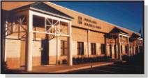
308 South Airport Road
Jackson, MS 39208-6649

601.933.2900 voice
601.933.2901 fax

The U.S. Geological Survey (USGS) provides maps, reports and information to help others meet their needs to manage, develop, and protect America's water, energy, mineral, and land resources. We help find natural resources needed to build tomorrow, and supply scientific understanding needed to help minimize or mitigate the effects of natural hazards and environmental damage caused by human activities. The results of our efforts touch the daily lives of almost every American.


State and National Streamflow Conditions
Click on the maps below to retrieve local or
national real-time data and station information.

Current streamflow conditions in Mississippi; click to go to a live map.
Map legend.


Accessibility || Disclaimer
Privacy Statement

 HURRICANE LINKS
LATEST GULF OF MEXICO IMAGE

Click to display this image in a separate window. Click here to get up to date satellite images of the Gulf of Mexico.


 HELPFUL LINKS
VISITING MISSISSIPPI?

The official website of
The Mississippi
Division of Tourism


Check out the
city guide for
Jackson, MS at
DiscoverOurTown.com

Visiting our office???
Click here to view a MS Water Science Center pamphlet (.pdf) which includes restaurant and hotel listings, and a map to our office! (136 Kb)


 HISTORY LESSON
LEWIS AND CLARK

The USGS continues many of the scientific investigations begun by Lewis and Clark and the Corps of Discovery....

Read More >>>

 USGS INTERNATIONAL
USGS IN BOTSWANA

Mississippi scientists taking flood-warning technology, materials to Botswana....

Read More >>>


07290000: Flow=1530cfs,Stage=9.29ft,Floodstage=28.0ft,2008-09-15 17:00,High,BIG BLACK RIVER NR BOVINA, MS 07295000: Flow=319cfs,Stage=4.82ft,Floodstage=20.0ft,2008-09-15 15:45,>90,BUFFALO RIVER NR WOODVILLE, MS 07291000: Flow=134cfs,Stage=6.97ft,2008-09-15 15:45,>90,HOMOCHITTO RIVER AT EDDICETON, MS 07290650: Flow=320cfs,Stage=3.16ft,2008-09-15 16:45,>90,BAYOU PIERRE NR WILLOWS, MS 07289350: Flow=1600cfs,Stage=10.45ft,Floodstage=15.0ft,2008-09-15 17:45,>90,BIG BLACK RIVER AT WEST, MS 07288500: Flow=1080cfs,Stage=6.21ft,2008-09-15 15:00,>90,BIG SUNFLOWER RIVER AT SUNFLOWER, MS 02490500: Flow=631cfs,Stage=6.51ft,Floodstage=15.0ft,2008-09-15 17:45,>90,BOGUE CHITTO NR TYLERTOWN, MS 02484500: Flow=363cfs,Stage=8.15ft,Floodstage=19.0ft,2008-09-15 16:00,>90,YOCKANOOKANY RIVER NR OFAHOMA, MS 02484000: Flow=146cfs,Stage=5.86ft,Floodstage=15.0ft,2008-09-15 17:45,>90,YOCKANOOKANY RIVER NR KOSCIUSKO, MS 02476500: Flow=32cfs,Stage=4.76ft,2008-09-15 17:00,>90,SOWASHEE CREEK AT MERIDIAN, MS 02475500: Flow=126cfs,Stage=2.88ft,Floodstage=22.0ft,2008-09-15 17:00,>90,CHUNKY RIVER NR CHUNKY, MS 02430880: Flow=4.5cfs,Stage=2.64ft,2008-09-15 17:45,<10,CUMMINGS CREEK NR FULTON, MS 02430615: Flow=2.7cfs,2008-09-15 17:45,0000-00-00 00:00:00,<10,MUD CREEK NR FAIRVIEW, MS 07283000: Flow=21cfs,Stage=2.18ft,Floodstage=31.0ft,2008-09-15 16:00,76-90,SKUNA RIVER AT BRUCE, MS 07274000: Flow=57cfs,Stage=2.69ft,Floodstage=25.0ft,2008-09-15 16:00,76-90,YOCONA RIVER NR OXFORD, MS 07268000: Flow=78cfs,Stage=9.72ft,Floodstage=25.0ft,2008-09-15 16:00,76-90,LITTLE TALLAHATCHIE RIVER AT ETTA, MS 07032200: Flow=7.4cfs,Stage=7.05ft,2008-09-15 17:15,76-90,NONCONNAH CREEK NEAR GERMANTOWN, TN 02492000: Flow=1350cfs,Stage=4.72ft,2008-09-15 17:00,76-90,Bogue Chitto River near Bush, LA 02489500: Flow=4510cfs,Stage=11.17ft,Floodstage=18.0ft,2008-09-15 17:00,76-90,Pearl River near Bogalusa, LA 02489000: Flow=3410cfs,Stage=2.81ft,Floodstage=17.0ft,2008-09-15 17:15,76-90,PEARL RIVER NR COLUMBIA, MS 02488500: Flow=2330cfs,Stage=6.47ft,Floodstage=22.0ft,2008-09-15 17:15,76-90,PEARL RIVER NR MONTICELLO, MS 02487500: Flow=102cfs,Stage=3.03ft,Floodstage=25.0ft,2008-09-15 17:45,76-90,STRONG RIVER AT D`LO, MS 02482550: Flow=471cfs,Stage=5.66ft,Floodstage=17.0ft,2008-09-15 16:00,76-90,PEARL RIVER NR CARTHAGE, MS 02482000: Flow=223cfs,Stage=4.25ft,Floodstage=20.0ft,2008-09-15 17:45,76-90,PEARL RIVER AT EDINBURG, MS 02479560: Flow=878cfs,Stage=5.75ft,2008-09-15 14:00,76-90,ESCATAWPA RIVER NEAR AGRICOLA MS 02479000: Flow=4350cfs,Stage=5.61ft,2008-09-15 17:15,76-90,PASCAGOULA RIVER AT MERRILL, MS 02477000: Flow=330cfs,Stage=5.56ft,Floodstage=25.0ft,2008-09-15 17:00,76-90,CHICKASAWHAY RIVER AT ENTERPRISE, MS 02476600: Flow=201cfs,Stage=4.16ft,2008-09-15 17:45,76-90,OKATIBBEE CREEK AT ARUNDEL, MS 02475000: Flow=2390cfs,Stage=5.43ft,2008-09-15 17:15,76-90,LEAF RIVER NR MCLAIN, MS 02474500: Flow=441cfs,Stage=6.36ft,2008-09-15 17:45,76-90,TALLAHALA CREEK NR RUNNELSTOWN, MS 02473500: Flow=84cfs,Stage=1.20ft,Floodstage=13.0ft,2008-09-15 17:45,76-90,TALLAHALA CREEK AT LAUREL, MS 02473000: Flow=1100cfs,Stage=2.36ft,Floodstage=22.0ft,2008-09-15 17:00,76-90,LEAF RIVER AT HATTIESBURG, MS 02472000: Flow=309cfs,Stage=4.56ft,Floodstage=25.0ft,2008-09-15 17:15,76-90,LEAF RIVER NR COLLINS, MS 02448500: Flow=176cfs,Stage=9.46ft,2008-09-15 14:00,76-90,NOXUBEE RIVER NR GEIGER, AL 02448000: Flow=148cfs,Stage=5.50ft,Floodstage=26.0ft,2008-09-15 16:00,76-90,NOXUBEE RIVER AT MACON, MS 02443500: Flow=234cfs,Stage=5.84ft,Floodstage=15.0ft,2008-09-15 16:15,76-90,LUXAPALLILA CREEK NR COLUMBUS, MS 07292500: Flow=352cfs,Stage=4.99ft,Floodstage=19.0ft,2008-09-15 15:15,25-75,HOMOCHITTO RIVER AT ROSETTA, MS 07030500: Flow=163cfs,Stage=1.66ft,Floodstage=13.0ft,2008-09-15 14:30,25-75,WOLF RIVER AT ROSSVILLE, TN 03592718: Flow=6.0cfs,Stage=5.31ft,2008-09-15 17:45,25-75,LITTLE YELLOW CREEK EAST NR BURNSVILLE, MS 02486000: Flow=345cfs,2008-09-15 16:45,Stage=4.47ft,2008-09-15 18:00:00,Floodstage=28.0ft,25-75,PEARL RIVER AT JACKSON, MS 02483000: Flow=29cfs,Stage=12.44ft,Floodstage=25.0ft,2008-09-15 16:00,25-75,TUSCOLAMETA CREEK AT WALNUT GROVE, MS 02481510: Flow=272cfs,2008-09-15 17:00,25-75,WOLF RIVER NR LANDON, MS 02481000: Flow=27cfs,Stage=0.90ft,2008-09-15 17:00,25-75,BILOXI RIVER AT WORTHAM, MS 02479300: Flow=292cfs,Stage=5.32ft,2008-09-15 15:15,25-75,RED CREEK AT VESTRY, MS 02479160: Flow=503cfs,Stage=5.14ft,2008-09-15 17:30,25-75,BLACK CREEK NR WIGGINS, MS 02479155: Flow=17cfs,Stage=5.85ft,2008-09-15 17:30,25-75,CYPRESS CREEK NR JANICE, MS 02479130: Flow=235cfs,Stage=4.07ft,Floodstage=20.0ft,2008-09-15 17:30,25-75,BLACK CREEK NR BROOKLYN, MS 02478500: Flow=1170cfs,Stage=9.71ft,2008-09-15 17:15,25-75,CHICKASAWHAY RIVER AT LEAKESVILLE, MS 02477990: Flow=106cfs,Stage=4.76ft,2008-09-15 17:00,25-75,BUCKATUNNA CREEK NR DENHAM, MS 02472500: Flow=139cfs,Stage=2.16ft,Floodstage=18.0ft,2008-09-15 17:45,25-75,BOUIE CREEK NR HATTIESBURG, MS 02439400: Flow=267cfs,Stage=5.53ft,Floodstage=13.0ft,2008-09-15 16:00,25-75,BUTTAHATCHEE RIVER NR ABERDEEN, MS 02436500: Flow=70cfs,Stage=6.47ft,2008-09-15 17:45,25-75,TOWN CREEK NR NETTLETON, MS 02433500: Flow=337cfs,Stage=3.90ft,Floodstage=14.0ft,2008-09-15 15:15,25-75,TOMBIGBEE RIVER AT BIGBEE, MS 02432500: Flow=16cfs,Stage=2.63ft,2008-09-15 16:00,25-75,BULL MOUNTAIN CREEK AT TREMONT, MS 02430085: Flow=3.7cfs,Stage=4.95ft,2008-09-15 16:00,25-75,RED BUD CREEK NR MOORES MILL, MS 333150090530400: Stage=4.45ft,2008-09-15 17:00:00,Not ranked,UNNAMED TRIBUTARY CLEAR CREEK NEAR NAPANEE, MS 330548091055100: Stage=15.06ft,2008-09-15 17:45:00,Not ranked,LK WASHINGTON TRIB AT STEIN RD NR CHATHAM, MS 330359090194135: Stage=6.96ft,2008-09-15 15:30:00,Not ranked,BEE LAKE NR THORNTON                   072873355 330304090210100: Stage=7.18ft,2008-09-15 17:45:00,Not ranked,BEE LAKE TRIBUTARY NO 1 NR THORNTON, MS 302318088512600: Stage=0.64ft,2008-09-15 17:15:00,Not ranked,BILOXI BAY AT POINT CADET HARBOR AT BILOXI, MS 302110088464600: Stage=7.00ft,2008-09-01 06:15:00,Not ranked,USCG BILOXI EAST CHANNEL RANGE FRONT LIGHT 301141089320300: Flow=26500cfs,2008-09-15 17:45,Not ranked,EAST PEARL RIVER AT CSX RAILROAD NR CLAIBORNE, MS 301058089313900: Stage=3.85ft,2008-09-01 03:30:00,Not ranked,USCG PEARL RIVER ENTRANCE CHANNEL LIGHT 7A 0728875070: Flow=496cfs,Stage=11.02ft,2008-09-15 15:30,Not ranked,DEER CREEK EAST OF LELAND, MS 0248557375: Stage=0.83ft,2008-09-15 17:40:00,Not ranked,UNNAMED TRIBUTARY TO MILL CREEK NR FLOWOOD, MS 0248018020: Stage=0.81ft,2008-09-15 17:30:00,Floodstage=8.0ft,Not ranked,ESCATAWPA RIVER AT I-10 NR ORANGE GROVE, MS 0247914380: Flow=2.1cfs,Stage=4.46ft,2008-09-15 17:40,Not ranked,PEARCES CREEK NR NEW AUGUSTA, MS 07375800: Flow=73cfs,Stage=2.11ft,Floodstage=9.0ft,2008-09-15 17:00,Not ranked,Tickfaw River at Liverpool, LA 07375300: Stage=4.89ft,2008-09-15 15:00:00,Floodstage=13.0ft,Not ranked,Tangipahoa River near Kentwood, LA 07375280: Flow=431cfs,Stage=9.41ft,2008-09-15 15:45,Not ranked,TANGIPAHOA RIVER AT OSYKA, MS 07373290: Stage=42.71ft,2008-07-23 11:00:00,Floodstage=48.0ft,Not ranked,(COE) Mississippi River at Red River Landing, LA 07373278: Stage=14.59ft,2008-09-15 14:00:00,Not ranked,Lake Saint John near Waterproof, LA 07369680: Flow=2660cfs,Stage=19.34ft,2008-09-15 16:00,Not ranked,Bayou Macon at Eudora, AR 07294800: Stage=33.57ft,2008-09-15 17:00:00,Not ranked,(COE) Mississippi River at Knox Landing, LA 07290880: Stage=25.73ft,2008-09-15 17:00:00,Not ranked,MISSISSIPPI RIVER AT NATCHEZ, MS 07289730: Flow=1060cfs,Stage=7.49ft,Floodstage=22.0ft,2008-09-15 17:00,Not ranked,BIG BLACK RIVER NR BENTONIA, MS 07289000: Stage=17.54ft,2008-09-15 16:48:00,Not ranked,MISSISSIPPI RIVER AT VICKSBURG, MS 07288955: Flow=32900cfs,2008-09-15 14:09,Not ranked,YAZOO RIVER BL STEELE BAYOU NR LONG LAKE, MS 07288650: Flow=820cfs,Stage=12.04ft,2008-09-15 15:00,Not ranked,BOGUE PHALIA NR LELAND, MS 07288280: Flow=344cfs,Stage=6.37ft,2008-09-15 17:00,Not ranked,BIG SUNFLOWER RIVER NR MERIGOLD, MS 07287400: Flow=54cfs,Stage=4.94ft,2008-09-15 16:15,Not ranked,BLACK CREEK AT LEXINGTON, MS 07287160: Flow=221cfs,Stage=6.53ft,2008-09-15 17:45,Not ranked,ABIACA CREEK AT CRUGER, MS 07287150: Flow=166cfs,Stage=8.25ft,2008-09-15 17:45,Not ranked,ABIACA CREEK NR SEVEN PINES, MS 07285510: 0000-00-00 00:00,Not ranked,YALOBUSHA RIVER AT NSI INTAKE AT GRENADA, MS 07285500: Flow=2740cfs,Stage=9.38ft,2008-09-15 17:30,Not ranked,YALOBUSHA RIVER AT GRENADA, MS 07282100: Stage=7.38ft,2008-09-15 14:45,Not ranked,Temporarily unavailable,TOPASHAW CREEK CANAL NR CALHOUN CITY, MS 07282097: Flow=2.0cfs,Stage=3.27ft,2008-09-15 15:30,Not ranked,BEAR CREEK CANAL NR DERMA, MS 07282090: Stage=2.51ft,2008-09-15 16:15,Not ranked,TOPASHAW CREEK CANAL NR DERMA, MS 07282075: Stage=7.32ft,2008-09-15 15:30,Not ranked,TOPASHAW CREEK CANAL NR HOHENLINDEN, MS 07282000: 2008-09-11 12:00,Stage=8.91ft,2008-09-15 16:00:00,Floodstage=23.0ft,Not ranked,Rating being developed or revised,YALOBUSHA R AND TOPASHAW C CA AT CALHOUN CITY, MS 07281977: Stage=9.10ft,2008-09-15 14:30,Not ranked,YALOBUSHA RIVER AT DERMA, MS 07281960: Stage=6.10ft,2008-09-15 17:00,Not ranked,YALOBUSHA RIVER AT VARDAMAN, MS 07281600: Flow=6680cfs,Stage=18.64ft,2008-09-15 15:00,Not ranked,TALLAHATCHIE RIVER AT MONEY, MS 07280400: Flow=18cfs,Stage=7.11ft,2008-09-15 15:45,Not ranked,TILLATOBA CREEK AT CHARLESTON, MS 07277730: Stage=8.04ft,2008-09-15 15:00:00,Not ranked,SENATOBIA CREEK NR SENATOBIA, MS 07277700: Flow=44cfs,Stage=3.66ft,2008-09-15 17:45,Not ranked,HICKAHALA CREEK NR SENATOBIA, MS 07275900: Flow=56cfs,Stage=2.21ft,Floodstage=11.0ft,2008-09-15 15:45,Not ranked,COLDWATER RIVER NR OLIVE BRANCH, MS 07265455: Stage=22.63ft,2008-09-15 17:00:00,Floodstage=48.0ft,Not ranked,MISSISSIPPI RIVER NR GREENVILLE, MS 07030392: Flow=85cfs,Stage=5.59ft,2008-09-15 17:45,Not ranked,WOLF RIVER AT LAGRANGE, TN 02492620: Stage=11.16ft,2008-09-15 18:00:00,Not ranked,PEARL RIVER AT NSTL STATION, MS 02492600: Stage=9.97ft,2008-09-15 16:00:00,Floodstage=14.0ft,Not ranked,Pearl River at Pearl River, LA 02492519: Stage=39.38ft,2008-09-15 17:00:00,Not ranked,Pearl River Navagation Canal Lock and Dam No. 1 02492511: Stage=14.00ft,2008-09-15 17:30:00,Not ranked,East Pearl River at I-59 near Nicholson, MS 02492360: Flow=80cfs,Stage=6.31ft,Floodstage=15.0ft,2008-09-15 17:45,Not ranked,WEST HOBOLOCHITTO CREEK NR MCNEILL, MS 02492343: Flow=103cfs,Stage=5.31ft,Floodstage=15.0ft,2008-09-15 17:45,Not ranked,EAST HOBOLOCHITTO CREEK NR CAESAR, MS 02492111: Stage=27.77ft,2008-09-15 17:00,Not ranked,WILSON SLOUGH NEAR WALKIAH BLUFF, MS 02492110: Stage=33.38ft,2008-09-15 17:00:00,Not ranked,EAST PEARL RIVER AB WILSON SL AT WALKIAH BLUFF, MS 02492100: Stage=26.20ft,2008-09-15 17:00:00,Not ranked,Pearl River Navagation Canal Lock and Dam No. 2 02490200: Stage=24.00ft,2008-09-15 17:00:00,Not ranked,Pearl River Navagation Canal Lock and Dam No. 3 02490193: Stage=57.75ft,2008-09-15 17:00:00,Not ranked,Pearl River at Pools Bluff near Bogalusa, LA 02486350: Stage=2.78ft,2008-09-15 15:00:00,Not ranked,CANY CREEK AT JACKSON, MS 02486100: 2008-09-15 00:15,Stage=3.33ft,2008-09-15 14:30:00,Not ranked,Temporarily unavailable,LYNCH CREEK AT JACKSON, MS 02485950: Stage=1.60ft,2008-09-15 16:00:00,Not ranked,TOWN CREEK AT JACKSON, MS 02485800: Stage=3.35ft,2008-09-15 15:45:00,Not ranked,EUBANKS CREEK AT JACKSON, MS 02485700: Flow=1.6cfs,Stage=7.28ft,2008-09-15 15:30,Not ranked,HANGING MOSS CREEK NR JACKSON, MS 02485601: Stage=251.21ft,2008-09-15 15:00:00,Not ranked,PEARL RIVER AT ROSS BARNETT RESERVOIR, MS 02485600: Stage=297.25ft,2008-09-15 15:00:00,Not ranked,ROSS BARNETT RESERVOIR NR JACKSON, MS 02485590: Stage=12.65ft,2008-09-15 17:45:00,Not ranked,MILL CREEK AT SPILLWAY ROAD NR LUCKNEY, MS 02485577: Stage=4.47ft,2008-09-15 17:00:00,Not ranked,MILL CR TRIB NO 1 AT GRANTS FERRY RD NR LUCKNEY,MS 02485575: 0000-00-00 00:00,Stage=3.58ft,2008-09-15 17:20:00,Not ranked,MILL CREEK TRIB NO 2 NR LUCKNEY, MS 02485574: Flow=1.0cfs,Stage=3.62ft,2008-09-15 17:00,Not ranked,MILL CREEK AT STATE HIGHWAY 25 NR LUCKNEY, MS 02485573: Stage=4.06ft,2008-09-15 17:15:00,Not ranked,MILL CREEK AT CASTLEWOODS BLVD NEAR LUCKNEY, MS 02485498: Stage=297.01ft,2008-09-15 17:30,Not ranked,PELAHATCHIE CREEK AT STATE HWY 25 NR FANNIN, MS 02484760: Stage=0.08ft,2008-09-15 17:00:00,Not ranked,FANNEGUSHA CREEK NR SAND HILL, MS 02484650: Stage=296.87ft,2008-09-15 17:00:00,Floodstage=303.0ft,Not ranked,PEARL RIVER AT RATLIFF`S FERRY NR RATLIFF, MS 02483500: Flow=948cfs,Stage=6.44ft,Floodstage=24.0ft,2008-09-15 16:00,Not ranked,PEARL RIVER NR LENA, MS 02483001: Flow=17cfs,Stage=15.20ft,2008-09-15 16:30,Not ranked,SOUTH CANAL TUSCOLAMETA CREEK NR WALNUT GROVE, MS 02481880: Flow=57cfs,Stage=5.62ft,Floodstage=13.0ft,2008-09-15 17:45,Not ranked,PEARL RIVER AT BURNSIDE, MS 02481660: Not ranked,JOURDAN RIVER NR BAY ST LOUIS, MS 02481299: Stage=0.25ft,2008-09-15 17:45:00,Not ranked,OLD FORT BAYOU AT OCEAN SPRINGS, MS 02481270: Stage=0.65ft,2008-09-15 17:45:00,Not ranked,BACK BAY OF BILOXI NEAR BILOXI, MISS. 02480285: Stage=0.48ft,2008-09-15 17:45:00,Not ranked,WEST PASCAGOULA RIVER AT HWY 90 AT GAUTIER, MS 02480273: Stage=0.88ft,2008-09-15 17:45:00,Not ranked,PASCAGOULA RIVER AT INTERSTATE 10 AT CROOKED BAYOU 02480212: Stage=0.68ft,2008-09-15 17:45:00,Not ranked,PASCAGOULA RIVER AT MI 1 AT PASCAGOULA, MS 02479980: Flow=14cfs,Stage=0.92ft,2008-09-15 16:30,Not ranked,CROOKED CREEK NEAR FAIRVIEW, AL. 02479945: Flow=28cfs,Stage=2.24ft,2008-09-15 15:30,Not ranked,BIG CREEK AT COUNTY RD 63 NEAR WILMER, AL. 02479310: Flow=7960cfs,Stage=7.16ft,Floodstage=16.0ft,2008-09-15 15:30,Not ranked,PASCAGOULA RIVER AT GRAHAM FERRY, MS 02479144: 2008-09-03 12:45,Stage=1.57ft,2008-09-15 14:30:00,Not ranked,PEARCES CREEK NR JANICE, MS 02479143: 2008-09-05 13:00,Stage=1.48ft,2008-09-15 17:25:00,Not ranked,MIDDLE CREEK NR BROOKLYN, MS 02474600: Flow=100cfs,2008-09-13 22:00,Stage=1.25ft,2008-09-15 15:00:00,Not ranked,BOGUE HOMO NR RICHTON, MS 02474560: Flow=2020cfs,Stage=3.58ft,2008-09-15 16:15,Not ranked,LEAF RIVER NR NEW AUGUSTA, MS 02473460: Flow=175cfs,2008-09-07 13:15,Stage=7.50ft,2008-09-15 16:00:00,Not ranked,TALLAHALA CREEK AT WALDRUP, MS 02472850: Flow=116cfs,Stage=7.51ft,2008-09-15 14:15,Not ranked,OKATOMA CREEK AT SANFORD, MS 02448900: Flow=10cfs,Stage=3.50ft,2008-09-15 15:45,Not ranked,BODKA CREEK NEAR GEIGER, AL. 02444500: Stage=109.36ft,2008-09-15 15:00:00,Not ranked,TOMBIGBEE RIVER NEAR COCHRANE, AL. 02444161: Stage=109.26ft,2008-09-15 15:00:00,Floodstage=122.0ft,Not ranked,TOMBIGBEE RIVER BEL BEVIL L&D NR PICKENSVILLE, AL. 02444160: Flow=1220cfs,Stage=136.45ft,2008-09-15 15:00,Not ranked,TOMBIGBEE RIVER AT BEVILL L&D NR PICKENSVILLE, AL 02441500: Stage=7.58ft,2008-09-15 16:42:00,Not ranked,TOMBIGBEE RIVER AT COLUMBUS, MS 02441390: 0000-00-00 00:00,Stage=63.31ft,2008-09-15 17:00:00,Floodstage=161.0ft,Not ranked,TOMBIGBEE RIVER AT STENNIS LOCK AND DAM, MS 02437100: 0000-00-00 00:00,Stage=40.31ft,2008-09-15 17:00:00,Floodstage=188.0ft,Not ranked,TOMBIGBEE RIVER AT ABERDEEN LOCK AND DAM, MS 02437000: Flow=2500cfs,2008-09-10 03:00,Stage=11.49ft,2008-09-15 16:45:00,Floodstage=20.0ft,Not ranked,TOMBIGBEE RIVER NR AMORY, MS 02431000: Flow=156cfs,Stage=7.38ft,Floodstage=20.0ft,2008-09-14 16:00,Not ranked,TOMBIGBEE RIVER NR FULTON, MS 02430680: Flow=1.5cfs,Stage=10.12ft,2008-09-15 17:45,Not ranked,TWENTYMILE CREEK NR GUNTOWN, MS 02430500: Stage=7.21ft,2008-09-15 16:00:00,Not ranked,TOMBIGBEE RIVER NR MARIETTA, MS Go to WaterWatch (offsite) for a larger map with additional options