Terra/Aqua MODIS: Snow Cover and Sea Ice Surface Temperature
|
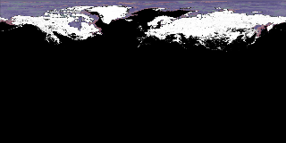
This animation shows MODIS daily measurements of both snow cover and sea ice surface temperature in the Northern Hemisphere for the winter of 2002-2003. MODIS can only take measurements in daylight, so measurements during the polar winter night are taken from the last valid measurement.
|
|

|
|
MODIS snow cover and sea ice surface temperature in the Northern Hemisphere from September 1, 2002 through May 31, 2003.
Duration: 9.0 seconds
Available formats:
2048x512
Frames
320x160
PNG
24 KB
160x80
PNG
7 KB
80x40
PNG
2 KB
1024x256 (25 fps)
MPEG-1
3 MB
1024x256 (25 fps)
MPEG-4
5 MB
How to play our movies
|
|
This product is available through our Web Map Service.
Click here to learn more.
|
|

|
|
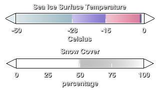
The legends for snow cover and sea ice surface temperature.
Available formats:
320 x 180
PNG
16 KB
|
|
|
Back to Top
|


