|
|
Check out our new Marine Weather Portal (press release)
Service Change Notice:
The Marine Weather Message (MWWTAE) hazard product, issued experimentally by the NWS Tallahassee forecast office since March 3, became official effective August 7. This service provides additional details on expected marine hazards, including the first ever marine watches. See the latest MWW issued by this office. Click here for additional details. Let us know what you think.
Going to the beach? Break the Grip of the Rip. Learning about rip currents could save a life. See our improved Surf Zone Forecast for local area beaches. A forecast of beach winds, surf heights, rip current risk, and UV Index are provided in this product, along with local tide information and observed surf temperatures.
Coastal Forecasts | Offshore Forecasts | Surf Zone Forecasts | Buoy
Observations & Analyses | Tides | Sea Surface Temps | Numerical Model Data | Other Marine Information
The National Weather Service in Tallahassee issues wind, wave and weather forecasts for the coastal waters of the Gulf of Mexico from the Suwannee River to Destin, FL, out to 60 nautical miles from shore. We also raise Small Craft Advisories, Gale Warnings, and other marine flags as necessary. To learn more about the advisory and warning headlines in our forecasts, see our Marine Weather FAQ page.
5-day Coastal Marine Forecasts
(Click on your area of interest below. Use the text links below the image for marine forecasts for elsewhere in Florida)

Similar clickable maps are available for the coastal waters of the
Florida, Georgia & S. Carolina
Central & Western U.S. Gulf Coast
Eastern Seaboard
Great Lakes (U.S. Shores)
West Coast
Alaska
Hawaii & Guam
Puerto Rico & the Virgin Islands
Offshore Marine Forecasts
(see a clickable
map)
Gulf of Mexico
Caribbean
Sea and the SW North Atlantic
High
Seas Forecasts
Surf Zone Forcasts
Western Florida Panhandle and Points West to Mississippi
Florida's Big Bend and Eastern Panhandle
Northeast Florida Coast & Georgia's Southeast Coast
East Central Florida Coast
Southeast & Southwest Florida Coasts
Marine Observations and Analyses
Interactive Marine Observations from the NDBC
Recent conditions at Mouth of St. John's River & at Fernandina Beach
Morning conditions at Bradenton Beach
OCS NowCOAST
Internet Mapping Portal of real-time coastal observations & forecasts
Tampa Bay PORTS Data (interactive map or a tabluar summary)
Marine Prediction Center analysis products
Coastal Ocean Monitoring & Prediction System (COMPS)
Satellite-Derived Winds & Other Products
Tide
Information
Graphs of Observed Tides vs. Astronomical Predictions
Panama City Beach, FL
Panama City, FL
Apalachicola, FL
Shell Point, FL (courtesy USF)
Cedar Key, FL
Elsewhere in Florida
Locations in Alabama
Locations in Georgia
Elsewhere in the U.S.
Text products listing the next several high and low tides for
St. Petersburg, FL
Key West & Vaca
Cut
Savannah River Entrance,
GA
Tables of Astronomical Tide Predictions for 2008
Cedar Key
Suwannee River Entrance
Steinhatchee River Entrance - Deadman Bay
Mandalay, Aucilla River
St. Mark's River Entrance
Bald Point - Ochlockonnee Bay
Turkey Point - St. James Island
Carrabelle
St. George Island, East End
St. George Island, 12th St. W. (Bayside)
St. George Island, Sikes Cut
Apalachicola
Port Saint Joe, St. Joseph Bay
St. Andrew Bay, Panama City
Panama City Beach (outside)
East Bay - Allanton
North Bay - Lynn Haven
West Bay Creek
East Pass (Destin)
Pensacola
Elsewhere along the Apalachee Bay and Panhandle Coasts
Other locations on the Gulf Coast
Other locations in Florida
Locations in Alabama
Locations in Georgia
Other locations in the U.S.
Mean
Sea Level Trends (Rises) for
Cedar
Key
Apalachicola
Panama
City
Pensacola
Elsewhere
in Florida
Elsewhere
in the U.S.
Sea
Surface Temperatures
Panama City Beach (included in the Surf Zone Forecast)
FSU Coastal & Marein Lab at Turkey Point
NEW:
Naval Oceanographic Office
NODC
Coastal Water Temperature Guide
Coastal Ocean Observation Lab
(high resolution imagery from Rutgers University)
Johns
Hopkins Univ. Applied Physics Lab
(high resolution imagery for the Gulf of Mexico and other regions)
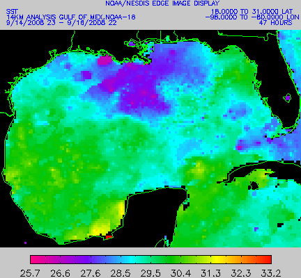
NESDIS
analyses for the Gulf
of Mexico or Other
Regions Worldwide
National
Hurricane Center analyses for the North
Atlantic Basin or Eastern
Pacific Basin
Numerical
Model Data
Interactive
NOAA Wavewatch III - 5-day
Wind & Wave Forecasts
(JavaScript required; also available in tabular
or text
formats)
Navy NOGAPS Model
- 6-day Wind & Wave
Forecasts
Other
information
NEW:
Beaufort Scale (descriptions;
color photos
)
Disclaimer:
All images at the above link are the property of Environment Canada and
are used by NOAA with its permission.
U.S.
Coast Guard
National Geodetic
Survery
Port Meteorological
Officers' Volunteer Observing Ship (VOS) Program
NOAA
Electronic Navigational Charts
Order the
most up-to-date paper nautical charts
here. Download Coast
Pilot
nautical books.
Marine
Services Charts
Marine
Product Dissemination Information
Radiofacsimile
Chart User's Guide
Notices
for Mariners Chart Updates
Definitions
Frequently Asked Questions
Please
address questions or comments about this page to the Marine Program
Focal Point
Mark Wool
|
|
Local
Climate, Water & Weather Topics:
Current
Hazards,
Current
Conditions,
Radar,
Satellite,
Climate,
Weather Safety,
Contact
Us |
|
National
Weather Service
Tallahassee Weather Forecast Office
Love Building
Florida State University
Tallahassee, FL 32306-4509
Phone: (850)
942-8833
FAX: (850) 942-8850
|
Disclaimer |
Privacy
Policy |
|


