

|
|
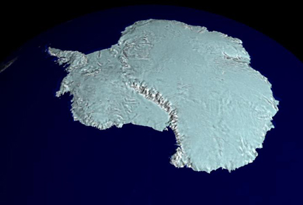
For 18 days during the Southern Hemisphere spring of 1997, a NASA-launched Canadian satellite called RADARSAT collected pieces of a puzzle that will help scientists study the most remote and inaccessible part of the Earth -- Antarctica. Scientists now have the puzzle pieces put together, forming the first high-resolution radar map of the mysterious frozen continent. Credits - NASA |