

Images & Animations
-
Credit
Jacques Descloitres, MODIS Land Rapid Response Team, NASA/GSFC
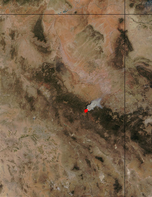
The Rodeo Fire in east-central Arizona is burning within the Fort Apache Indian Reservation about 100 miles east-northeast of Phoenix (seen southwest of the fire as a large area of grayish pixels surrounded by scattered spots of dark green vegetation). The fire was about 48,000 acres as of June 20, 2002, and was 0 percent contained. These images from the Moderate Resolution Imaging Spectroradiometer (MODIS) on the Terra satellite was captured on June 19, 2002. In the false-color image the vegetation is green, and burned areas are red.
Metadata
-
Sensor
Terra/MODIS -
Visualization Date
2002-06-20