Oregon District Active Projects
OR001 Surface Water Stations
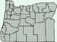
 Study area

PROJECT CHIEF: Tom Herrett
LOCATION: State of Oregon
PROJECT EXTENT: Statewide
BACKGROUND
Surface-water information is needed for purposes of surveillance, planning,
design, hazard warning, operation, and management in water-related fields such
as water supply, hydroelectric power, flood control, irrigation, bridge and
culvert design, wildlife management, pollution abatement, flood-plain
management, and water resources development. To provide this information an
appropriate data base is necessary.
OBJECTIVES
- A. To collect surface-water data sufficient to satisfy needs for current-
purpose uses, such as:
- Water-resource assessments
- Reservoir operation
- Forecasting
- Industrial operations
- Waste disposal
- Pollution controls
- Discharge data to accompany water-quality measurements
- Compact and legal requirements
- Research or special studies.
- B. To collect data necessary to define for any location the
statistical properties of and trends in water in streams, lakes,
estuaries, etc., for use in planning and design.
APPROACH
Standard methods of data collection will be used as described in the
series, "Techniques of Water-Resources Investigations of the United
States Geological Survey." Partial-record gaging will be used instead
of complete-record gaging where it serves the required purpose.
STREAMFLOW MONITORING NETWORK STATUS
The Oregon network collects the following data:
- Discharge at 181 continuous-record gaging stations on streams, canals, and drains
- Discharge at 47 partial-record and miscellaneous sites
- Water quality at 127 stream sites
- Water quality at 2 atmospheric deposition stations
- Water quality at 11 ground-water sites
- Stage and/or contents for 26 lakes and reservoirs

[Active Projects Page] |
[Oregon District Home Page]
 <Send questions or comments to bjfisher@usgs.gov>
U.S. Department of the Interior |
U.S. Geological Survey
URL: http://or.water.usgs.gov/proj/or001/or001.html
Maintainer: Oregon Webteam
Last modified Thursday - Jul 26, 2007 at 13:54:35 EDT
Privacy Statement ·
Disclaimer ·
FOIA ·
Accessibility


 Study area