Advanced Hydrologic Prediction Service: Raleigh: Fishing Creek near Enfield
Skip Navigation Linkweather.gov 
NOAA logo - Click to go to the NOAA homepage National Weather Service   NWS logo - Click to go to the NWS homepage
Advanced Hydrologic Prediction Service

Fishing Creek near Enfield, NC (EFDN7)

Data Type


Inundation Levels
NAVD88 Stage

96.223.0
95.222.0
94.221.0

Major Flooding Begins

93.220.0
92.219.0

Moderate Flooding Begins

91.218.0
90.217.0

Flooding Begins

89.216.0
88.215.0
87.214.0
86.213.0
85.212.0


  Map Zoom In Map Zoom In Map Zoom In Map Zoom In Map Zoom In Map Zoom In Map Zoom In Map Zoom In Map Zoom In
Weather Forecast Office Raleigh, NC Southeast River Forecast Center

To see all current watches and warnings, click here.
Scale Map

Hydrograph River at a Glance Download Inundation
Mapping
Weekly Chance of
Exceeding Levels
Chance of Exceeding Levels
During Entire Period
Image Type:
Current Stage: 3.98 ft at 23:00 UTC 01/15
Map Zoom In Map Zoom In Map Zoom In Map Zoom In Map Zoom In Map Zoom In Map Zoom In Map Zoom In Map Zoom In
Please wait while the page loads.
DFIRM Data Not Available   (See FAQ)

Selected Inundation
NAVD88: N/A ft
Stage: N/A ft

Print / Save Image
About Inundation
Download Dataset(s)
FAQ
User Guide
Inundation Sites
Mouse Location*
Latitude: N/A N
Longitude: N/A W
* All mouse location values are estimates only.

Zoom InClick on the image to zoom in

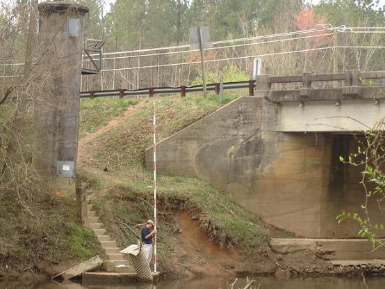
Graphical representation of flood inundation for NWS flood categories are based on steady state hydraulic modeling of water surface elevations for incremented discharges. Map shows approximate inundation areas for given water surface elevations and should not be used for navigation or permitting or other legal purposes, but strictly as a planning reference tool.

North Arrow Flood Categories (in feet)
Major Flood Stage:20
Moderate Flood Stage:18
Flood Stage:16
Action Stage:16
Below Flood Stage:

USGS Gauge Location USGS Gauge Location

Extent of Inundation Study Boundaries Extent of Inundation Study Boundaries

Historical Crests
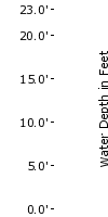
(1) 22.10 ft on 04/19/1910
(2) 21.65 ft on 09/18/1999
(3) 21.60 ft on 07/24/1916
(4) 19.72 ft on 08/18/1940
(5) 19.66 ft on 12/02/1934
Show More Historical Crests

Return to Area Map

Impacts & Photos Collapse
26.0 ROADWAY AND US301 BRIDGE BEGIN TO FLOOD. INHABITED AREAS MAY ALSO BE AFFECTED AT THIS STAGE.
20.0 RIVER OVERFLOWS INTO BRUSH AND FARMLAND.
16.0 MINOR OVERFLOW OCCURS ON BOTH BANKS.
Photos
(1) Gauge Site
(2) Downstream to Gauge Site

Other Data Sources:
U.S. Geological Survey (USGS) Data and Site Info for Enfield

Additional Information Collapse

Gage Photos

Gage Photo


Resources Collapse
Hydrologic Resources
Additional Resources
   

Collaborative Agencies Collapse
The National Weather Service prepares its forecasts and other services in collaboration with agencies like the US Geological Survey, US Bureau of Reclamation, US Army Corps of Engineers, Natural Resource Conservation Service, National Park Service, ALERT Users Group, Bureau of Indian Affairs, and many state and local emergency managers across the country. For details, please click here.

NWS Information
National Weather Service
Raleigh Weather Forecast Office
1005 Capability Drive, Suite 300
Raleigh, NC 27606
(919) 515-8209
Ask Questions/Webmaster
Page last modified: 12-Jun-2008 4:20 PM
Disclaimer
Credits
Glossary
Privacy Policy
About Us
Career Opportunities