Program Status for 31 January 2001 : IOP 04
Status |
Forecast Discussion |
Aircraft Status |
Flight Plan |
Soundings Status |
Special Notes
Status
| January 31 1100 PST |
Super IOP in progress |
|---|
| February 1 |
Proposed flight 1100 PST
Mission: Storm surveillance, fluxes, IMPROVE coordination.
Weather briefing at 0830 (PST) |
|---|
Status |
Forecast Discussion |
Aircraft Status |
Flight Plan |
Soundings Status |
Special Notes
PACJET IOP4 Short Term Forecast Discussion
National Weather Service/PACJET Operations Center, Monterey, CA
2245 UTC January 31, 2001
Discussion: The highly amplified ridge now overhead the west coast will
flatten over the next 24 hours as strong jet energy...extending across
the eastern Pacific...approaches the Pacific Northwest. Latest model
runs from 12Z this morning appear fairly well initialized...though it
did look like they were a little slow with the 6 hour forecast valid at
18Z in the handling of the initial short wave now approaching 45N/140W.
The main vort center that is crossing 40N/155W appears on track with
current forecasts. Today's PACJET flight is sampling in this region...
and hopefully will provide valuable data for the initialization of the
00Z model runs.
In any case...appears that conditions are taking shape for a significant
precipitation event for the Pacific Northwest given the strength of the
incoming system and ample available moisture (precipitable water values
exceeding an inch as far north as 50N). Appears warm advection precip
will spread down from Vancouver Island into northwest Washington by
midday Thursday. Precipitation will then increase across western
Washington and western Oregon Thursday night and early Friday as the
cold front moves onshore. Strong southerly flow of 50 to 70 knots at 850
mbs will enhance rainfall along south and southwest facing slopes. Moist
westerly onshore flow behind the front will keep moderate precipitation
going across much of the Pacific Northwest through Friday. Current
thinking here is that some light precipitation will make it about as far
south as areas north of the Bay Area and Sacramento by late Friday as
the front washes out across northern California.
ECMWF and MRF now in better agreement with a weaker system approaching
the Oregon coast by late Sunday.
Rowe
Status |
Forecast Discussion |
Aircraft Status |
Flight Plan |
Soundings Status |
Special Notes
| Aircraft Status |
|---|
| January 31 |
Super IOP Flight, take-off 1030 (PST).
|
|---|
| February 1 |
Proposed flight 1100 PST.
|
|---|
| February 2 |
Proposed flight TBD.
|
|---|
Status |
Forecast Discussion |
Aircraft Status |
Flight Plan |
Soundings Status |
Special Notes
IOP 4 Flight Track

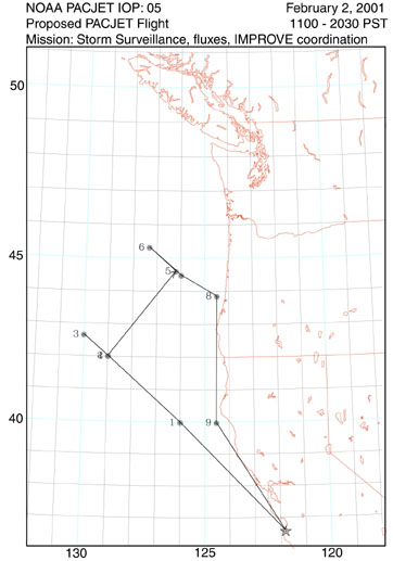
IOP 5 Flight Track
Status |
Forecast Discussion |
Aircraft Status |
Flight Plan |
Soundings Status |
Special Notes
| Soundings Status |
|---|
| 31 January |
|---|
| Bodega Bay | No soundings. |
| Cazadero | No soundings. |
| Oakland | No special soundings. |
| Reno | No special soundings. |
| 1 February |
|---|
| Bodega Bay | No soundings. |
| Cazadero | No soundings. |
| Oakland | No special soundings. |
| Reno | No special soundings. |
| 2 February |
|---|
| Bodega Bay | Possible soundings. TBD 1 Feb. |
| Cazadero | No soundings. |
| Oakland | Possible special soundings. TBD 1 Feb. |
| Reno | No special soundings. |
Status |
Forecast Discussion |
Aircraft Status |
Flight Plan |
Soundings Status |
Special Notes
|  ESRL Home |
PSD/ETL Home |
About PSD |
Programs |
Observing Systems |
About Our Transition |
Search |
Staff
ESRL Home |
PSD/ETL Home |
About PSD |
Programs |
Observing Systems |
About Our Transition |
Search |
Staff