


 SGP Central Facility


The ARM Program deploys specialized remote sensing instruments in a fixed location at the site to gather atmospheric data of unprecedented quality, consistency, and completeness. More than 30 instrument clusters have been placed around the site; the central facility; and the boundary, intermediate, and extended facilities. The locations for the instruments were chosen so that the measurements reflect conditions over the typical distribution of land uses within the site.
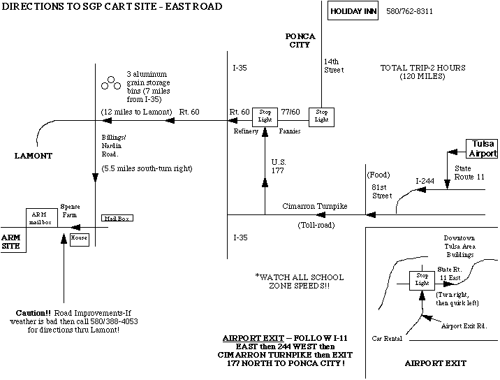
The Central Facility, located near Lamont, in north-central Oklahoma, houses the core instrumentation for the Southern Great Plains (SGP) site and is the center of operations for SGP experiments. The facility houses a wide range of in-situ and remote sensing instrumentation, including a millimeter-wavelength cloud radar, micropulse lidars, microwave radiometers, a ceilometer, several radar wind profilers, and the only continuously operated Raman lidar in existence. The Central Facility's state-of-the-art instrumentation is augmented by balloon-borne atmospheric profiling, surface radiation measurements and surface latent and sensible heat flux measurements. Because of its extensive collection of in-situ and ground-based remote sensing instruments, it is an ideal site for major collaborative field projects.
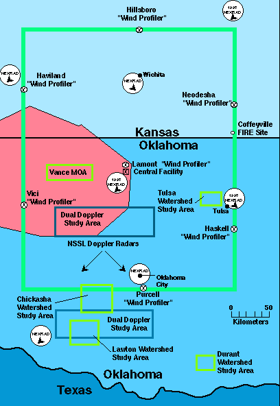
View an overview map of the SGP site or scan the geographic information table.
Instruments
Current list of Central Facility instruments.