|
Pacific
Offshore
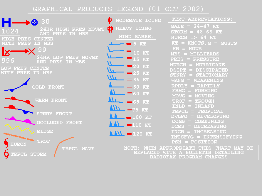
NOTE: If you are interested in printing the
marine weather charts listed on this page a TIFF viewer is required to have a
white background. Also, the black & white GIF
images are available for printing, but they are not ideally sized
for printing the complete chart. The GIF marine weather charts are
colored and have a black background.
Time delay of analysis products: Graphic
analysis/forecast charts broadcast by radio facsimile are
available by the Pacific
radio facsimile broadcast time and are usually available 30
minutes prior to broadcast.
Transmission
Times for the Offshore Forecasts.
Standard Time
| Z difference |
Atlantic |
Eastern |
Central |
Mountain |
Pacific |
Alaska |
Hawaii |
| -4 |
-5 |
-6 |
-7 |
-8 |
-9 |
-10 |
problems or comments?
NOTE: The terms Coordinated Universal Time (UTC) and Zulu
(Z) are equivalent.
Marine Weather Discussion
Description of Marine
Weather Discussion (MWD) & the
 Glossary of Abbreviations used in the MWD Glossary of Abbreviations used in the MWD
Marine Weather Discussion (N of 30N
E of 150W) |
Alternate version with help for abbreviations - Last updated:
02:23Z, 25 August 2009
Offshore Text Forecasts
Description of
Offshore Waters Text Forecast
Offshore Waters Forecast
(Washington and Oregon waters from 60 NM to 250 NM Offshore)
Last updated:
03:56Z, 25 August 2009
Offshore Waters Forecast (California
waters from 60 NM to 250 NM Offshore) Last updated:
03:56Z, 25 August 2009
Coastal
& Offshore Forecasts (additional forecasts)
NAVTEX Coastal & Offshore
Text Forecasts
Description of
NAVTEX Text Forecast
Coastal & Offshore
Waters Forecast (Canadian Border to Point Saint George,
California) Last updated:
03:59Z, 25 August 2009
Coastal &
Offshore Waters Forecast (Point Saint George, California
to Point Piedras Blancas, California) Last updated:
03:59Z, 25 August 2009
Coastal & Offshore
Waters Forecast (Point Piedras Blancas, California to Mexican
Border) Last updated:
03:59Z, 25 August 2009
Offshore Graphic Products
 |
|
Last Update:
03:35Z, 25 August 2009
|
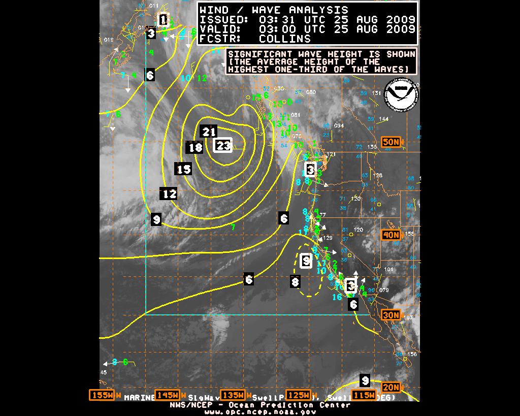
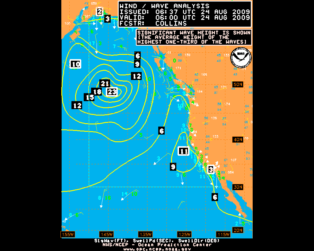
Description of Offshore
& Adjacent Waters Wind/Wave Analysis
Forecast
charts from 00Z model run
| Time
from 00Z |
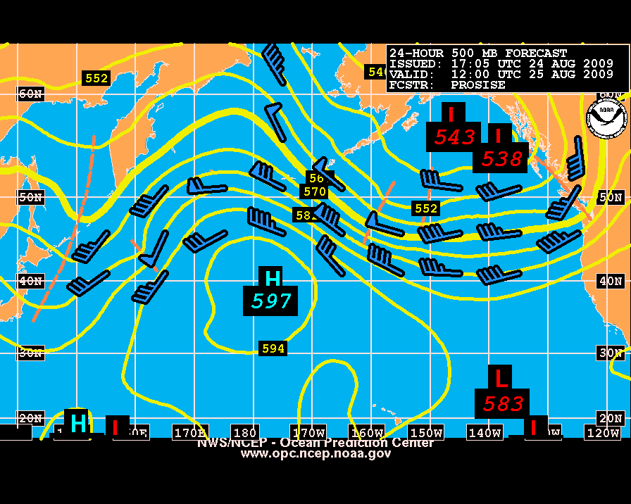
500
mb |
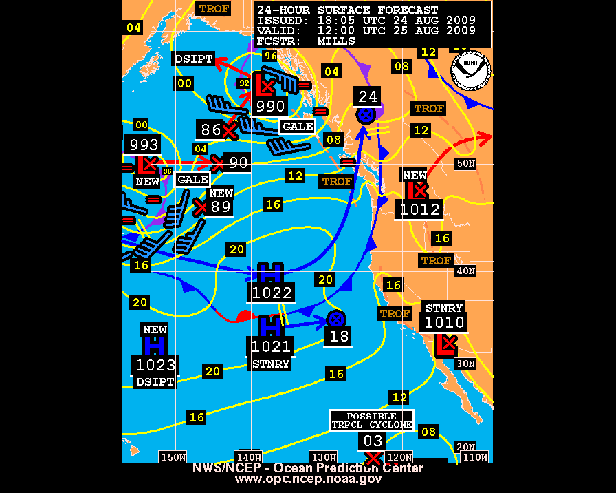
Surface
Analysis |
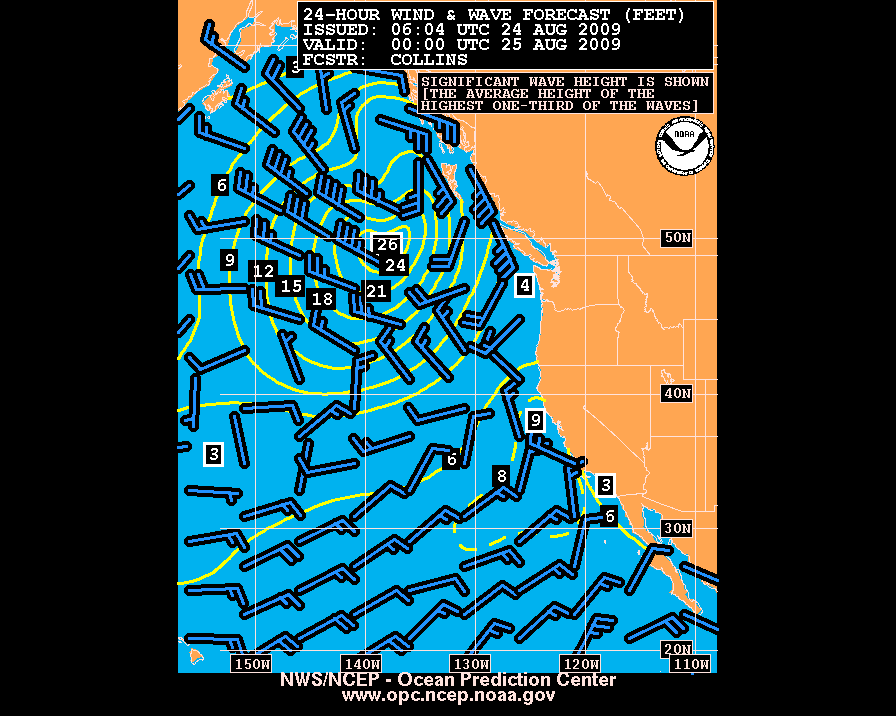
Wind&Wave
|
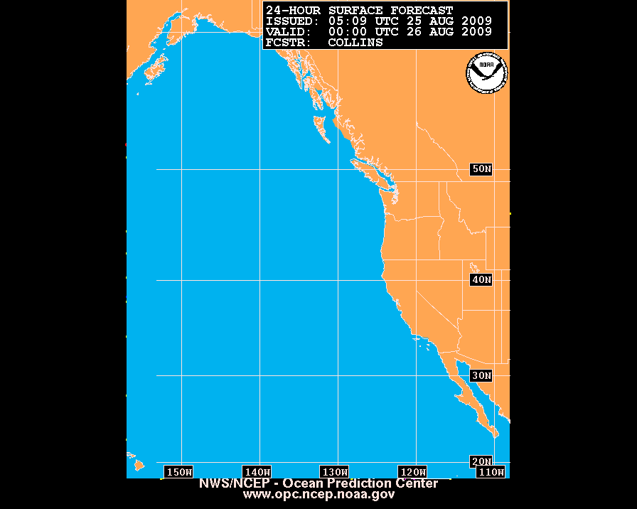
| 24 hour forecast |
(description)
Offshore & Adjacent Areas ( 28N- 52N, 45W-85W)
TIF|GIF|B/W
GIF
Last updated: 04:50Z, 25 August 2009
|
(description)
Offshore & Adjacent (25N-60N, East of 155W)
TIF|GIF|B/W
GIF
Last updated:
05:33Z, 24 August 2009
Offshore & Adjacent areas through to Alaska waters
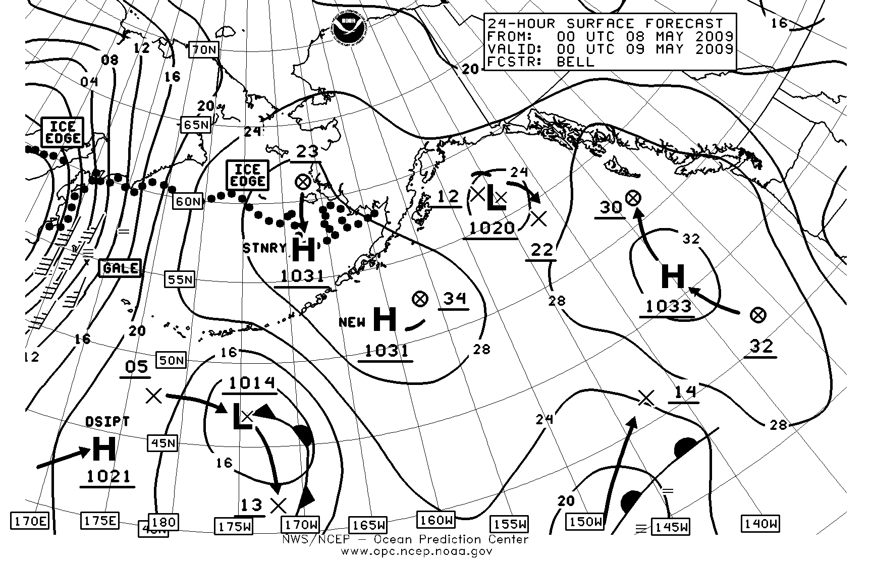
(40N-70N, 115W-170E)***
TIF|GIF|B/W
GIF
|
(description)
Offshore & Adjacent Areas (25N-60N, East of 155W)
TIF|GIF|B/W
GIF
Last updated:
06:09Z, 24 August 2009
Offshore & Adjacent areas through to Alaska waters
(40N-70N, 115W-170E)***
TIF|GIF|B/W
GIF
|
Forecast
charts from 12Z model run
| Time
from 12Z |
500
mb |
Surface
Analysis |
Wind&Wave
|
| 24 hour forecast |
(description)
Offshore & Adjacent Areas ( 28N- 52N, 45W-85W)
TIF|GIF|B/W
GIF
Last updated: 17:16Z, 24 August 2009
|
(description)
Offshore & Adjacent Areas (25N-60N,
East of 155W)
TIF|GIF|B/W
GIF
Last updated:
18:09Z, 24 August 2009
Offshore & Adjacent areas through to Alaska waters
(40N-70N, 115W-170E)***
TIF|GIF|B/W
GIF
|
(description)
Offshore & Adjacent Areas (25N-60N,
East of 155W)
TIF|GIF|B/W
GIF
Last updated:
18:04Z, 24 August 2009
Offshore & Adjacent areas through to Alaska waters
(40N-70N, 115W-170E)***
TIF|GIF|B/W
GIF
|
|


