 |
 | |
  | |
|
|
|
|
Glacier National Park
Hiking the Trails
|
|
|
|
|
|
 |

|
| Bill Hayden, NPS |
| Sunset from Granite Park |
|
 |
| David Restivo, NPS | | The bridge over Avalanche Gorge is one of the hightlights of the Trails of the Cedars Nature Trail |
 |
Over half of the visitors to Glacier National Park report taking a hike. That’s a lot of hikers, but over 700 miles of trail provide many outstanding opportunities for both short hikes and extended backpacking trips.
Hikers need to assume individual responsibility for planning their trips and hiking safely. Before setting out on your hike, stop by a park visitor center to obtain needed warnings and recommondations. You will increase your odds of a safe hike, decrease your disturbance to park wildlife, and lessen cumulative damage to resources.
Visitor center bookstores carry a complete line of trail guides, topographic maps and field guides to aid the hiker. Publications are also available by mail. Visit the online bookstore.
Self-guided walks interpret trailside features with brochures and signs. The Trail of the Cedars, Forest and Fire, Hidden Lake, Sun Point, Running Eagle Falls, and Swiftcurrent Nature Trails encourage hikers to experience Glacier National Park at their own pace. The Trail of the Cedars and Running Eagle Falls are wheelchair accessible.
|
|
Trail Status
Detailed reports on trail status are available online here. The reports are updated each morning or anytime new information is obtained.
Trail Maps
Good day hikes are plentiful. Visitor Center Staff will be happy to assist you with your choices and provide a map to park trails. The interactive Flash maps, at the links below, provide information on the most popular hiking destinations. The Logan Pass and Many Glacier maps are a little larger than the others and may take a minute or two to open depending on your Internet connection speed.
|
|
|
|
|
|
|
|
|
|
|
|
|
|
|
|
 |
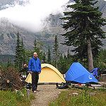
| David Restivo, NPS | | Backcountry Camping |
 |
Overnight Trips
Hikers planning to camp overnight in Glacier’s backcountry must stop at a visitor center or ranger station and obtain a backcountry permit.
|
|

|
 |
|
|
|
|
|
 |
|
Did You Know?
Grizzly bears in the park have a wide variety of food sources, including glacier lily bulbs, insects, and berries. They may also make an early season meal of mountain goats that were swept down in avalanches over the winter.
|
|
|
|
Last Updated: July 18, 2008 at 11:37 EST |


