Oregon's State Scenic Waterways law (ORS 390.805-390.925) enacted in 1970 specifies that all fills and removals in State Scenic Waterways require a permit from the Department, except for recreational non-motorized prospecting, fish and wildlife management facilities and stream gauge stations (ORS 390.835).
Oregon's Scenic Waterways program was created to enable all federal, state, and local agencies, individual property owners and recreational users to work together to protect and wisely use Oregon's rivers.
Special Note on Placer Mining in State Scenic Waterways
With the sunsetting on December 31, 2005 of a provision of law allowing recreational placer mining in state scenic waterways, the Department of State Lands is no longer authorized by law to issue placer mining permits in these waterways.
Can I use my suction dredge to placer mine in an Oregon Scenic Waterway?
No, since January 1, 2006 any recreational placer mining dredging permits issued by DSL for that activity on Oregon Scenic Waterways are no longer valid. Furthermore, DSL no longer has authority to issue new dredging permits. By operation of state law, after December 31, 2005 there can be no valid DSL permits for recreational placer mining by dredging on scenic waterways.
How did it happen that dredging is no longer permitted in Oregon Scenic Waterways?
The 2001 Oregon Legislature passed a law that in essence says that if the Oregon Parks and Recreation Department (OPRD) did not submit to either the 2003 or 2005 Legislature a report on the Scenic Waterway Program (“…including a review of the studies pertaining to the effects of recreational placer mining within scenic waterways”) then any permit for dredging “…for the purpose of recreational placer mining within a scenic waterway is not valid….” When OPRD did not submit the report by the close of the 2005 legislative session, the part of the law that prohibited dredging took effect on January 1, 2006.
In November 2005, in preparation for the law coming into effect, DSL started the process to change its rules to conform to the scenic waterway law. The new rules were enacted in January 2006. DSL is the agency under state law charged with regulating placer mining within scenic waterways.
More Information
 Oregon Parks and Recreation Department Scenic Waterways Oregon Parks and Recreation Department Scenic Waterways
The following lakes and rivers, or segments of rivers, and related adjacent land are designated as scenic waterways:
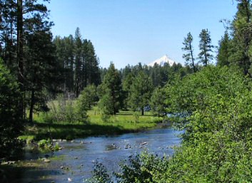
(1) The Metolius Scenic Waterway which includes the Metolius River from Metolius Springs downstream to its confluence with Candle Creek.
Metolius Headwaters photo Jill Burnett
(2) The Klamath Scenic Waterway which includes the Klamath River from the John Boyle Dam powerhouse downstream to the Oregon-California border.
(3) The Clackamas Scenic Waterway which includes:
(a) The segments of the Clackamas River from the boundary of the Olallie Lake Scenic Area, as constituted on December 8, 1988, downstream to the North Fork Reservoir, and from immediately below the River Mill Dam downstream to the bridge at Carver;
(b) The South Fork Clackamas River from its confluence with an unnamed tributary near the western boundary of Section 7, Township 5 South, Range 5 East, Willamette Meridian, downstream to the confluence of the South Fork Clackamas River with the Clackamas River; and
(c) The North Fork Clackamas River from its source downstream to the North Fork Reservoir.
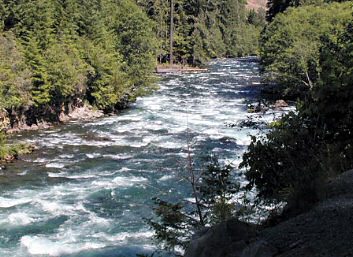
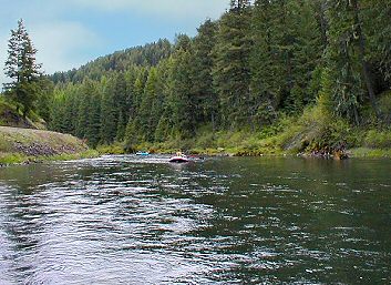
(4) The McKenzie Scenic Waterway which includes:
(a) The segments of the McKenzie River from Clear Lake downstream to Carmen Reservoir, from Tamolitch Falls downstream to Trail Bridge Reservoir and from Trail Bridge Dam downstream to Paradise Campground; and
(b) The segments of the South Fork McKenzie River from the boundary of the Three Sisters Wilderness, as constituted on December 8, 1988, downstream to Cougar Reservoir, and from immediately below Cougar Dam downstream to its confluence with the McKenzie River.
Mckenzie River Steve Morrow
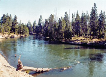
(5) The Deschutes Scenic Waterway which includes the segments of the Deschutes River from Little Lava Lake downstream to Crane Prairie Reservoir, from the gaging station immediately below Wickiup Dam downstream to General Patch Bridge, from Harper Bridge downstream to the Central Oregon Irrigation District´s diversion structure (near river mile 171), from Robert Sawyer Park downstream to Tumalo State Park, from Deschutes Market Road Bridge downstream to Lake Billy Chinook Reservoir (excluding the Cline Falls hydroelectric facility near river mile 145), and from immediately below the existing Pelton reregulating dam downstream to the confluence of the Deschutes River with the Columbia River, excluding the City of Maupin as its boundaries are constituted on October 4, 1977.
Deschutes River photo Vickie Nokleby
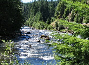
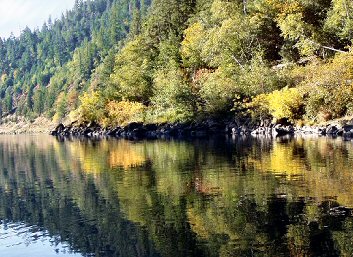
(6) The Santiam Scenic Waterway which includes the Little North Fork of the Santiam River from the confluence of Battle Ax Creek and Opal Creek downstream to the boundary of the Willamette National Forest, as constituted on September 20, 1985.
Santiam River photo Jill Burnett
(7) The John Day Scenic Waterway which includes:
(a) The John Day River from its confluence with Parrish Creek downstream to Tumwater Falls;
(b) The North Fork John Day River from the boundary of the North Fork John Day Wilderness (near river mile 76), as constituted on December 8, 1988, downstream to river mile 20.2 (northern boundary of the south one-half of Section 20, Township 8 South, Range 28 East, Willamette Meridian)
(c) The Middle Fork John Day River from its confluence with Crawford Creek (near river mile 71) downstream to the confluence of the Middle Fork John Day River with the North Fork John Day River; and
(d) The South Fork John Day River from the Post-Paulina road crossing (near river mile 35) downstream to the northern boundary of the Murderer´s Creek Wildlife Area, as constituted on December 8, 1988 (near river mile 6).
(8) The Illinois Scenic Waterway which includes the Illinois River from its confluence with Deer Creek downstream to its confluence with the Rogue River.
(9) The Rogue Scenic Waterway which includes the segments of the Rogue River from the boundary of Crater Lake National Park, as constituted on December 8, 1988, downstream to the east boundary of the Rogue River National Forest, as constituted on December 8, 1988 (near river mile 173), and from the confluence of the Rogue River with the Applegate River downstream to Lobster Creek Bridge.
Rogue River photo Steve Brutscher, OPRD
(10) The Umpqua Scenic Waterway which includes the segments of the North Umpqua River from the boundary of the Mt. Thielsen Wilderness, as constituted on December 8, 1988, downstream to Lemolo Reservoir, and from the Soda Springs Dam powerhouse downstream to its confluence with Rock Creek (near Idleyld Park).
(11) The Nestucca Scenic Waterway which includes:
(a) The Nestucca River from immediately below the McGuire Dam downstream to its confluence with East Creek (near Blaine); and
(b) Walker Creek from its source downstream to its confluence with the Nestucca River.
Nestucca River photo Tony Stein, ODFW
(12) The Wallowa-Grande Ronde Scenic Waterway which includes:
(a) The Grande Ronde River from its confluence with the Wallowa River downstream to the Oregon-Washington border; and
(b) The Wallowa River from its confluence with the Minam River downstream to the confluence of the Wallowa River with the Grande Ronde River.
Wallowa River photo Steve Brutscher, OPRD
(13) The Minam Scenic Waterway which includes the Minam River from Minam Lake downstream to its confluence with the Wallowa River.
(14) The Elk Scenic Waterway which includes:
(a) The Elk River from the confluence of the North Fork Elk River and South Fork Elk River downstream to the Elk River fish hatchery;
(b) The North Fork Elk River from its source downstream to its confluence with the South Fork Elk River; and
(c) The South Fork Elk River from its source downstream to its confluence with the North Fork Elk River.
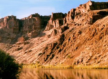
(15) The Owyhee Scenic Waterway which includes:
(a) The South Fork Owyhee River from the Oregon-Idaho border downstream to Three Forks; and
(b) The Owyhee River from Crooked Creek (near river mile 118) downstream to the mouth of Birch Creek (near river mile 76).
Owyhee River photo Gary Halvorson, Oregon State Archives
(16) The North Fork of the Middle Fork Willamette Scenic Waterway which includes the North Fork of the Middle Fork Willamette River from Waldo Lake downstream to a point one mile upstream from the railroad bridge near the town of Westfir.
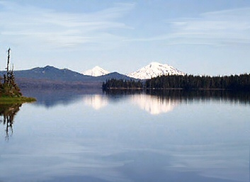
(17) The Waldo Lake Scenic Waterway which includes Waldo Lake in Lane County.
Waldo Lake staff photo
(18) The Sandy River Scenic Waterway which includes the Sandy River from its confluence with the Bull Run River downstream to the Stark Street Bridge.
Sandy River at Troutdale photo Jill Burnett
|