National Agricultural Statistics Service
NASS Factoids
Random words and images that represent what NASS offers
HomeAbout UsNewsroomPublicationsData and StatisticsCensus of AgricultureSurveysHelpContact Us
 
Search NASS
 
Go
 
  Advanced search  
  Search Tips  
  Browse NASS by Subject  
  Crops and Plants  
  Demographics  
  Economics  
  Environmental  
  Livestock and Animals  
  Charts and Maps  
  Research  
  Education and Outreach  
  Statistics_by_State  


Research and Science

Spatial Data
 

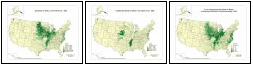
Vegetation Condition Images

Census of Agriculture
 

2002 Census Map Gallery
Map Gallery

2002 Maps:  Gallery | Star Tree | List

Interact with Data (1997)

"Linked Micromap" Plots (1997):
       Corn | Cotton | Hay | Soybeans | Wheat

Animated Maps
 
Crop Acreage Animation
Veg condition animated map
   
Reports, Papers and Presentations
 

Research Reports
 - New!  Access archived reports by subject area:
    GIS | Survey | Yield

2004 MEXSAI "Star Tree" Diagram
     Ron Bosecker, Presenter


Last modified: 10/04/07


Also See
Research Fellow and Associate Program
Seasonal Summary of Crop Progress and Condition
Remotely Sensed Data
Crop Acreage
Crop Yield
Future Vision
Media Help
 To view animated map files you must have Quicktime installed on your computer.
NASS Home | USDA.gov | FEDSTATS | Economics Statistics System (ESS) | Site Map | Translate | USA.gov | White House
FOIA | Accessibility Statement | Privacy Policy | Non-Discrimination Statement | Information Quality | Guidance Documents