Brooks Range
BLM
U.S. DEPARTMENT OF THE INTERIOR
BUREAU OF LAND MANAGEMENT
Grizzly along the Denali Highway Rafting the Gulkana National Wild River Native woman drying salmon on racks ATV rider on trails near Glennallen Surveyor
Alaska
BLM>Alaska>Programs>Energy>Oil and Gas>National Petroleum Reserve - Alaska>NPR-A Maps
Print Page

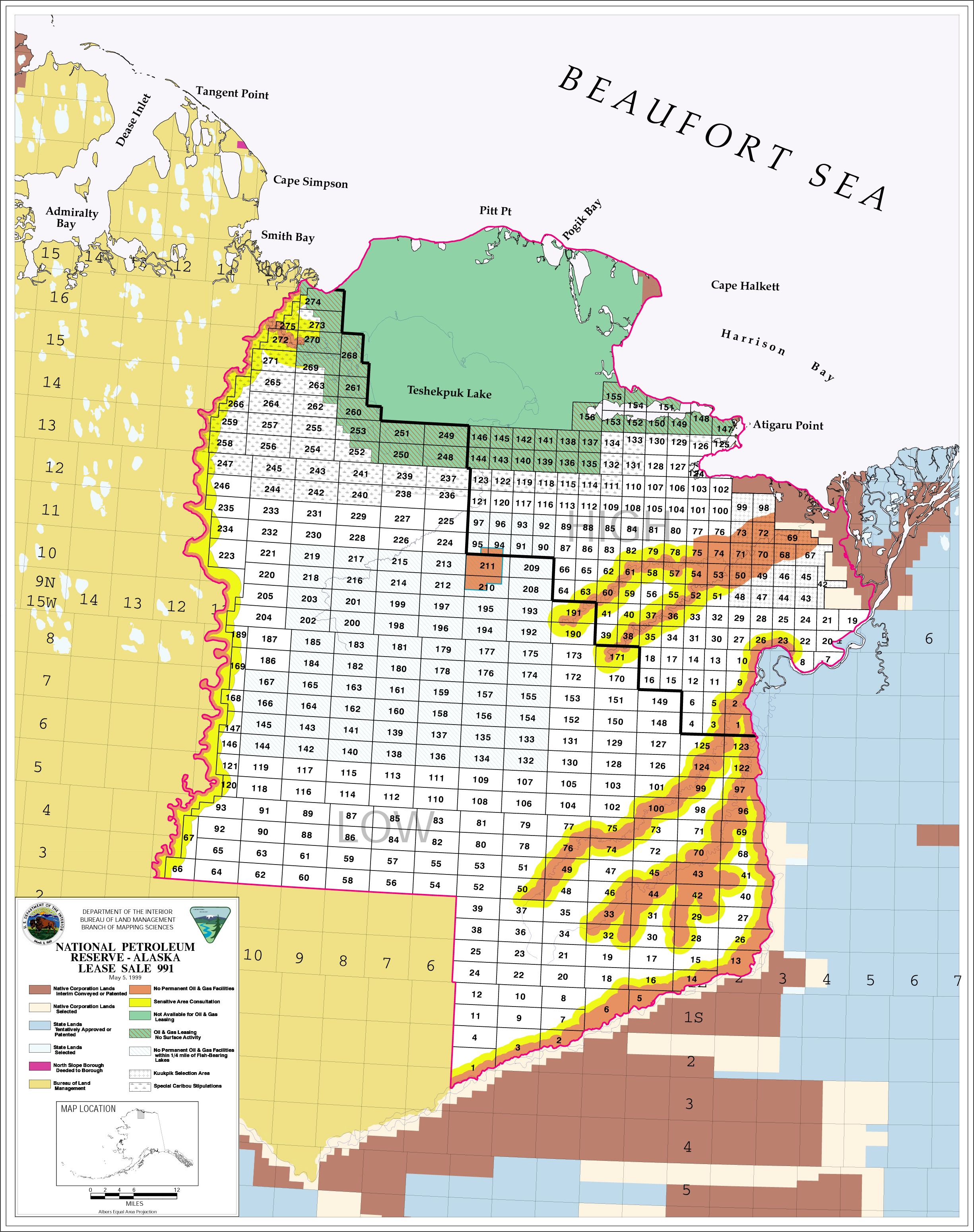
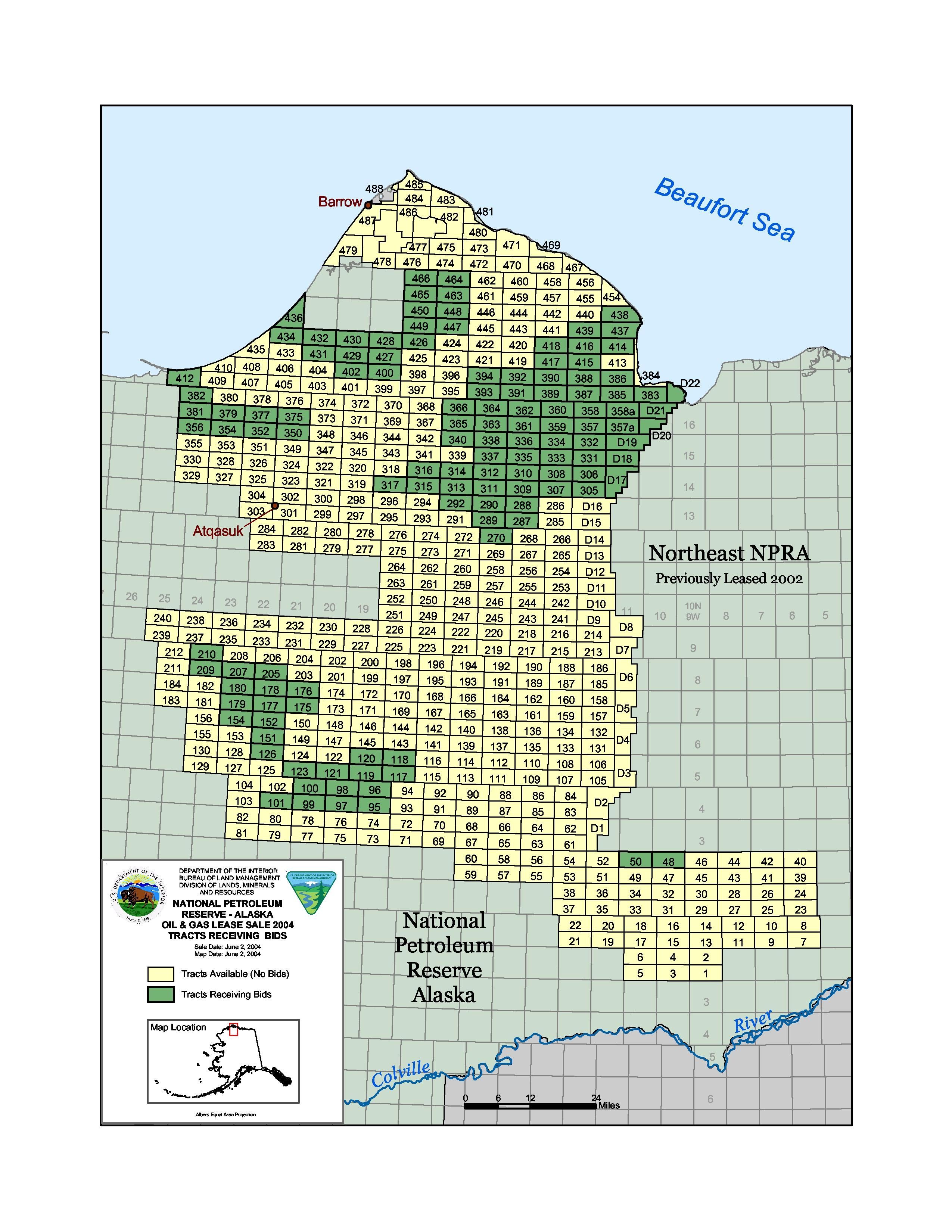
National Petroleum Reserve - Alaska Maps

MAP - 1999 NE NPR-A Original Lease Sale Tracts

(3.6 MB.jpg) >

Click on thumbnail to view 1999 Official Sale Tract Map

MAP - 1999 NE NPR-A original sale results (251 KB .pdf) >

View spreadsheet of the original 1999 lease sale figures.

Click on thumbnail to view the 1999 original sale results map

MAP - 2002 NE NPR-A official sale tracts (2.74 MB.jpg) >

Click on thumbnail to view 2002 Official Sale Tract Map

MAP - 2002 NE NPR-A original sale results (252 KB.pdf) >

View  spreadsheet of original 2002 lease sale figures.

Click on thumbnail to view the 2002 original sale results map

MAP - 2004 NW NPR-A  official sale tracts (6.07 MB.jpg) >

Click on thumbnail to view 2004 Official Sale Tract Map

MAP - 2004 NW NPR-A original sale results (2.45 MB.jpg) >

View spreadsheet of original 2004 lease sale figures.

Click on thumbnail to view the 2004 original sale results map

MAP - 2006 NW NPR-A official lease sale tracts >

MAP- 2006 NW NPR-A original lease sale results >

MAP - Current NPR-A  leases and wells. (2.4 MB.pdf) >

MAP - NE and NW NPR-A leases and operators with Colville River Special Area.(4 MB.pdf) >

View spreadsheet of current NPR-A leases and their stats

Click on thumbnail to view a large PDF file of the Current Leases and Owners

 Map of the NPR-A Greater Mooses Tooth Unit --->

Click on thumbnail to view a large .pdf image of the Greater Mooses Tooth Unit


 View CURRENT NPR-A Lease Sale Data with Leases and Operator Ownership(s):