Go to the NASS Home Page U.S. Department of Agriculture
National Agricultural Statistics Service
Research and Development Division
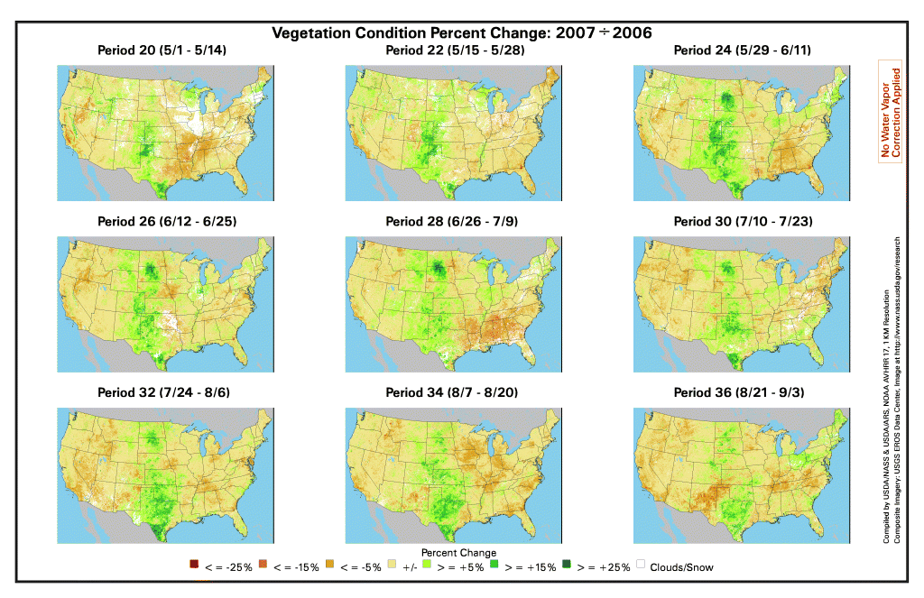
USDA Search:

2007 VEGETATION CONDITION
08/21 - 09/03/2007

COMPARABLE 2006 PERIOD: 08/23 - 09/05/2006

NDVI data calculated from the AVHRR sensor on the NOAA-17 satellite are used to create vegetation condition imagery beginning in March of the 2004 crop season. No water vapor correction was applied. The images selectable below include displays of the NDVI index for selected US areas. Median and ratio images to prior years are shown. Agricultural Statistics District (ASD) and/or county boundaries are shown where the resolution allows. Thumbnail images, which start when at least eight prior periods are available, allow season to-date review. US images with average first frost isolines overlaying NDVI are available starting with the period containing September 1st. Select a GIF or PDF image to view from the tables below. Images are in GIF format unless otherwise noted.
 
Biweekly NDVI Displays:
2007 Continental US US w/Average 1st Frost 2006 Comparable Period
KS/OK '07& '06 ND/SD/NE '07& '06 IL/IN/IA/MO '07& '06 Pacific NW '07& '06
Southeast US '07& '06 CA/NV '07& '06 Miss. Delta '07& '06 Texas '07& '06
Northeast '07& '06 Southwest '07& '06 Nebraska '07  

Ratio Comparison to Median, in Percent:
Continental US US w/Average 1st Frost 9 Period US Thumbnail Pacific NW
KS/OK ND/SD/MN IL/IN/IA/MO TX/LA
Southeast California/Nevada Miss. Delta  
Northeast Southwest Nebraska

Ratio Comparison to Previous Year, in Percent:
Continental US US w/Average 1st Frost 9 Period US Thumbnail Pacific NW
KS/OK ND/SD/MN IL/IN/IA/MO TX/LA
Southeast California/Nevada Miss. Delta  
Northeast Southwest Nebraska  

Browse Continental US (PDF Format)
Biweekly NDVI Biweekly NDVI w/Frost
Median/Previous Median/Previous w/Frost
Ratio/Previous Ratio/Previous w/Frost


Growing Season Animations | Weekly Weather & Crop Bulletin
Select Another Period/Year? [ Back | Return to Main Menu ]