| weather.gov |

 National Weather Service Forecast Office National Weather Service Forecast OfficeMelbourne, FL |
|||||
|
|
|||||||
|
|
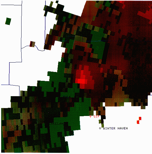
The Central Florida Tornado Outbreak of February 22nd & 23rd, 1998 The National Weather Service Office in Melbourne, Florida has developed a comprehensive database on Florida weather history with a special emphasis on Florida Tornadoes. Climatological information and the latest information on tornado research can be found on our research page. You can also visit our archive of storm summaries... Overview... On February 22, 1998, a massive and powerful weather system approached central Florida from the northwest and Gulf of Mexico. Later that night, thunderstorms associated with this storm system spawned three tornado-producing supercells, and we've all seen the tragic results. The magnitude of the tornado outbreak is such that it would be difficult to meaningfully depict actual tornado damage in this format. Intensive damage assessments and surveys are being conducted and when completed, will be made available. These graphics depict an approximate track of the thunderstorm "supercells" which produced the mesocyclones associated with the tornadoes that raked Central Florida on the 22nd & 23rd of February, 1998. These mesocyclone tracks are approximated from radar imagery. Some of the imagery is provided here as well, for a preliminary overview. Below are a series of reflectivity and storm-relative velocity images. The scale to the right of each image reveals the associated radar return in dBZ (reflectivity; brighter colors equate to heavier rainfall) and wind speed in knots (storm relative velocity; green colors indicate motion toward the radar site, while red colors indicate motion away from the radar site; in this case the
Mesocyclone 1 primarily affected Volusia County, near De Leon Springs and then Daytona Beach. Radar imagery associated primarily with mesocyclone 1:
Mesocyclone 2  Mesocyclone 2 primarily affected areas of Orange, Seminole, and Volusia Counties passing from Winter Garden and Ocoee through Longwood, Sanford, Osteen and finally Edgewater. Radar images associated primarily with mesocyclone 2:
Mesocyclone 3 
Mesocyclone 3 primarily affected area from Intersession city through Kissimmee in Osceola County then to near Titusville and Cape Canaveral in Brevard County.   Reflectivity product from February 23, 1998 at 12:10 AM
Here are a few pictures representative of some of the damage in the Kissimmee area... Read about the EL NINO connection with central Florida severe weather.
NWS Melbourne was deeply affected by the tragedy of the tornadoes that struck on the night of February 22nd & 23rd, 1998. We extend our heartfelt condolences to our neighbors who have lost friends, family members, homes, and property to these terrible storms. |
||||||||
|
|||||||||