USGS - science for a changing world

USGS Education

The USGS and Science Education

The U.S. Geological Survey provides scientific information intended to help educate the public about natural resources, natural hazards, geospatial data, and issues that affect our quality of life. Discover selected online resources, including lessons, data, maps, and more, to support teaching, learning, education (K-12), and university-level inquiry and research.

 
What's New, What's Happening Educational Resources Of Special Interest

Featured Topic

Thumbnail of hurricane
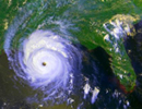
Monitoring Natural Hazards

Wildfires, hurricanes, volcanic eruptions, earthquakes – they’re all happening at the same time! Teachers and students can track current events using the interactive overview map at the USGS Natural Hazards Support System, which monitors natural hazard events as they are occurring anywhere on earth! For major events in the U.S., go to the USGS Emergency Operations Web site to download satellite images, GIS data, and other resources.

USGS Educational Resources For Primary Grades Grades K-6

USGS Educational Resources For Secondary Grades Grades 7-12

USGS Educational Resources For Undergraduate Education Community Colleges and Universities

USGS Resources For California's Education Standards (K-12)
This Web site links selected online resources to an established list of Science and History-Social Science content standards for California.

Schoolyard Geology
Activities and examples of ways to turn a "field trip" through your own schoolyard into a rich geologic experience.

The "GIS Lab"
Lessons, data, and information about using Geographic Information Systems (GIS) and spatial analysis in education.

The "GPS Class"
Lessons and information about using Global Positioning Systems (GPS) in education.

USGS Publications
Search database of over 69,000 USGS maps, books, and other publications.

USGS Store
Use the USGS Store to browse and purchase paper maps and other products that are popular with educators. Just enter the Store and click on "Education Products".Teacher Discounts are available for the purchase of USGS paper maps.

USGS Photo and Image Collections
A comprehensive list of USGS photos and images for public use.

Ask A Geologist
Can't find the information you need? Receive a personal response from a USGS scientist.

Thumbnail of the CoreCast cover artUSGS CoreCast! The New USGS Podcast Series!
USGS CoreCast brings you straight science insight on natural hazards; climate change; satellite imagery and monitoring; water quality; human health and wildlife disease; and much more. It's natural science from the inside out.

Videos and Animations
A collection of USGS videos and animations covering a wide range of science.

Find A Map!
Links to popular USGS map resources and map databases, including the: The National Map, and The National Atlas.

Our Changing Planet
Think that geography is just memorizing state capitals? With these USGS resources and lessons, you'll be investigating our changing planet!

Careers in Science
Web resources and videos about USGS Science and Careers.

USGS Education Resource for Teachers
Incorporate USGS science in lesson-planning with help from this convenient brochure.

Earth Science Week 2008
Encourage young people to learn about the geosciences by getting away from the television, off the computer, and out of doors. Earth Science Week 2008: "No Child Left Inside" is October 12-18, 2008. Use the USGS Earth Science Week Web site to find outdoor destinations recommended by USGS scientists plus additional resources for parents and teachers!

Ground-Water Availablity in the U.S.
Ground water is among the Nation's most important natural resources. It provides half our drinking water and is essential to agriculture, industry, and ecosystems. Learn what's known about our Nation's ground water in this new USGS Circular.

Alaska's Erupting Volcanoes
Kasatochi, Cleveland, and Okmok volcanoes in Alaska all erupted this summer. Why does Alaska have more than 80 active volcanoes? This Dynamic Earth: the Story of Plate Tectonics is a highly recommended, easy to understand primer full of illustrations and photos.

Free satellite Images
Most USGS Landsat satellite imagery and high-altitude photography can now be downloaded at no charge. Use the USGS Global Visualization Viewer (GloVis) to explore and download.

Parasites in the Food Web
New research suggests that parasites, many of which could be at risk of extinction, may be playing a critical, unrecognized role in the food web.

Geology of Canada and North America
A groundbreaking new DVD from the CBC, Geologic Journey, blends state-of-the-art science and film making with personal stories to document the history of Canada's landscape. Much of the science applies to all of North America. Download a 70-page Teacher Resource Guide.

USGS Polar Resources
Examine USGS research and resources in support of the International Polar Year.


Accessibility FOIA Privacy Policies and Notices

Take Pride in America logo USA.gov logo U.S. Department of the Interior | U.S. Geological Survey
URL: http://education.usgs.gov/index.html
Page Contact Information: USGS Education Web Team
Page Last Modified: Wednesday, 03-Sep-2008 17:31:06 EDT