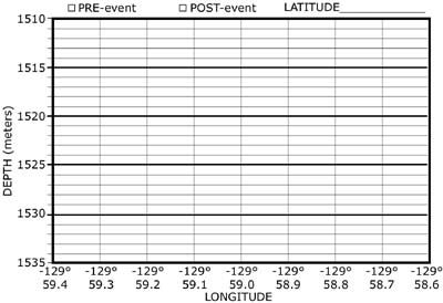
POST-EVENT
BATHYMETRIC MAP
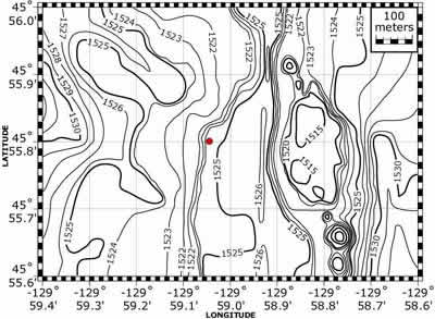
THE MAPS AND THE WORKSHEET
Notice
that the axes are different for the two maps (PRE and POST) and the contour
profile worksheet. The maps have latitude on the vertical y-axis, whereas
the worksheet has depth on the y-axis.
Both the maps and the worksheet have longitude on the horizontal x-axis
and they are the same size so that they can be overlain on each other.
We are going to transfer depth information from the maps along a single
east-west line of latitude onto a vertical cross section on the profile
worksheet to look for changes in depth due to the lava eruption.
CONTOUR
PROFILE WORKSHEET
Version
2.0 


 page
41 of 55
page
41 of 55