|
|
projects > surface-water cooperative data program
Surface-Water Cooperative Data Program
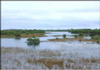
The Water Resources Division of the U.S. Geological Survey, in cooperation with State, County, and other Federal agencies, obtains a large amount of data pertaining to the water resources of Florida each water year. These data, accumulated during many water years, constitute a valuable data base for developing an improved understanding of the water resources of the State. To make these data readily available to interested parties outside the Geological Survey, the data are published annually in this report series entitled "Water Resources Data - Florida, Volume 2A: South Florida Surface Water and Volume 2B: South Florida Ground Water." (You can download introductory text for both the Surface Water (PDF, 567 Kb) and the Groundwater (PDF, 631 Kb) reports for the 1999 Water Year. You will need the free Adobe Acrobat Reader to view these files.) This report series includes records of stage, discharge, ground-water levels, and water quality of streams, and stage, contents, and water quality of lakes, and ground-water wells. The data for south Florida include continuous or daily discharge for 75 streams, continuous or daily stage for 121 streams (includes stage published at discharge and stage only sites), continuous elevations for 1 lake; continuous ground-water levels for 210 wells, periodic ground-water levels for 215 wells; quality-of-water data for 25 surface-water sites and 117 wells. For more information on USGS Surface-water, please read Stream-Gaging Program of the U.S. Geological Survey (USGS Circular 1123) or visit the National Streamflow Information Program website and the National Streamgaging Program webpage. PublicationsAbstracts
Water Data Reports
Related Links |
U.S. Department of the Interior, U.S. Geological Survey
This page is: http://sofia.usgs.gov/projects/index.php?project_url=sw_coop
Comments and suggestions? Contact: Heather Henkel - Webmaster
Last updated: 26 August 2008 @ 11:30 AM (BJM)