Skip Navigation Linksweather.gov 
Go to NOAA's main page Go to the NWS main page National Weather Service Forecast Office

Midland/Odessa, TX
background graphic

Local weather forecast by
"City, St" or zip code


HOME > Headlines

Link to Dust Devil Dispatch Active Fires Across Southwest Texas

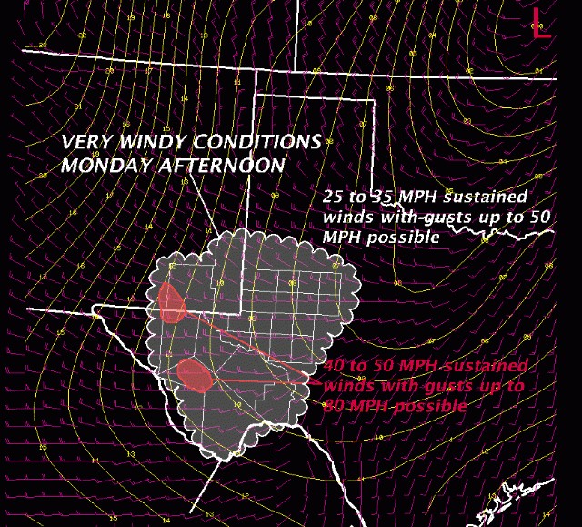
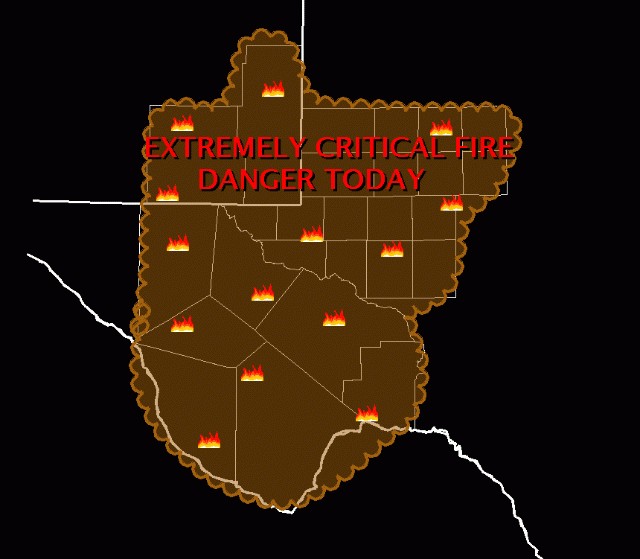
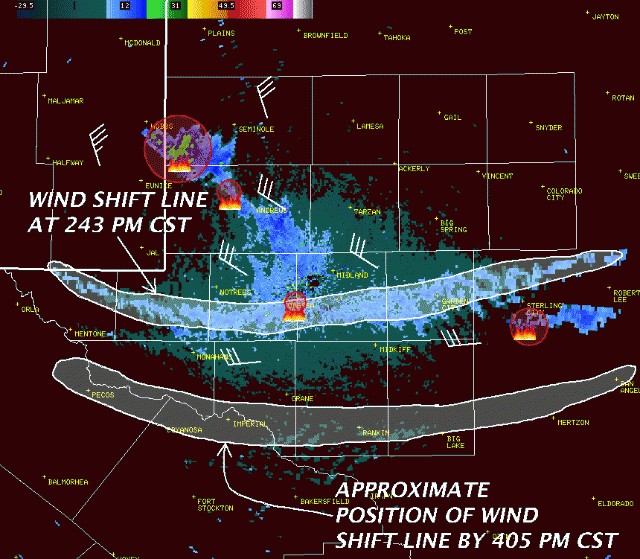
A surface low pressure system that developed earlier today has resulted in very windy conditions across all of southwest Texas and southeast New Mexico this afternoon. Extremely critical fire weather and multiple fires continue across the region.

Image #1 described in text


Image #2 described in text


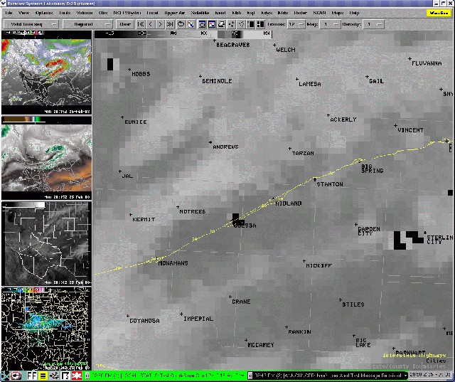
The satellite image below shows the active fires at 250 PM CST. The black pixels on the image show the "hot spots".

Image #3 described in text


A wind shift line, followed by a cool front, will move through the area this evening. The fires that are visible on radar are circled in red below.

Image #4 described in text


Other Recent Headlines:

10/4/2008 - WINDS AND SEVERE WEATHER POSSIBLE
9/27/2008 - Flooding Continues Along the Rio Grande
9/25/2008 - Flooding Continues on Rio Grande
9/25/2008 - Significant Flooding on the Rio Grande
9/24/2008 - Significant River Flooding Continues
9/23/2008 - Major Flooding Along The Rio Grande
9/22/2008 - Major Flooding Continues at Presidio
9/21/2008 - Rio Grande Conditions Slowly Improving
9/21/2008 - Rio Grande Flooding Continues
9/21/2008 - Photos of the Rio Grande Flooding


National Weather Service
Midland/Odessa Weather Forecast Office
2500 Challenger Drive
Midland, TX   79706
Phone: 432-563-5006
Web Master's E-mail: sr-maf.webmaster@noaa.gov
Disclaimer
Credits
Glossary
Comments/Feedback
Privacy Policy
About Us
Career Opportunities