Habitat Assessment and Marine Chemistry: Coastal Mapping
|
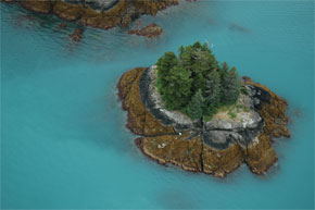
Icy Bay, Prince William Sound. |
To understand the quantity and quality of nearshore habitat
available along Alaska’s coastline
we are currently using the ShoreZone system to map the coastline. This
standardized system catalogs both geomorphic and biological resources at
mapping scales of better than 1:10,000. You can "fly the coastline"
(video), view still photos, and access biophysical data using an interactive
ArcIMS Website.
This ShoreZone database include four regions (Southeast, Aleutians,
Prince William Sound, Arctic),
and will be increased in succeeding years as new mapping and locations are
added. Also, this data is linked to the
Fish Atlas database.
Please see links below.
 |
|
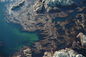
Prince of Wales Is., Southeast Alaska. |
|
Related Links
Coastal Alaska Mapping and Imagery
NMFS Alaska Regional Office online map databases
Washington State shore photos
British Columbia online map viewer
Seaweeds of Alaska
Contacts
Mandy Lindeberg
Auke Bay Laboratories
Alaska Fisheries Science Center, NOAA Fisheries
Ted Stevens Marine Research Institute
17109 Pt Lena Loop Rd
Juneau AK 99801
(907) 789-6616
Mandy.Lindeberg@noaa.gov
|