
Click on image to view the movie
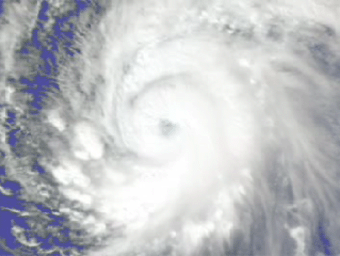
The AIRS sounder reveals important new information to supplement the
familiar overhead views of hurricanes that come from satellites. Here
AIRS shows some of the internal temperature structure of Supertyphoon
Pongsona just as it hit the island of Guam last December of 2002. Each of the
colored surfaces represents a particular temperature, from red and
warm near the surface to yellow and very cold near the top. Normally,
these so-called isotherms would be much smoother and nearly
horizontal. Here we see how the latent heat released in convective
updrafts causes the isotherms to bulge upward. This bulging is even
seen more than 50,000 feet above sea level. This relatively warm air
cap above a hurricane has rarely been observed and can only be
measured with an instrument like AIRS. As we zoom in on the lower
30,000 feet, the temperature structure becomes more striking. It is
even possible to discern a dip in the center at the lowest level,
where cooler and drier air descends and forms the often cloud free
eye of a hurricane.
The Atmospheric Infrared Sounder (AIRS) in conjunction with the Advanced
Microwave Sounding Unit (AMSU) sense emitted infrared and microwave
radiation from the Earth to provide a three-dimensional look at Earth's
weather and climate. Working in tandem, the two instruments can make
simultaneous observations all the way down to the Earth's surface, even in
the presence of heavy clouds. With more than 2,000 channels sensing
different regions of the atmosphere, the system creates a global, 3-D map
of atmospheric temperature and humidity, cloud amounts and heights,
greenhouse gas concentrations, and many other atmospheric phenomena. The
AIRS and AMSU fly onboard NASA's Aqua spacecraft and are managed by the
Jet Propulsion Laboratory, Pasadena, California, under contract to NASA.
JPL is a division of the California Institute of Technology in Pasadena.
The AIRS Public Web site can be found at http://airs.jpl.nasa.gov.

