
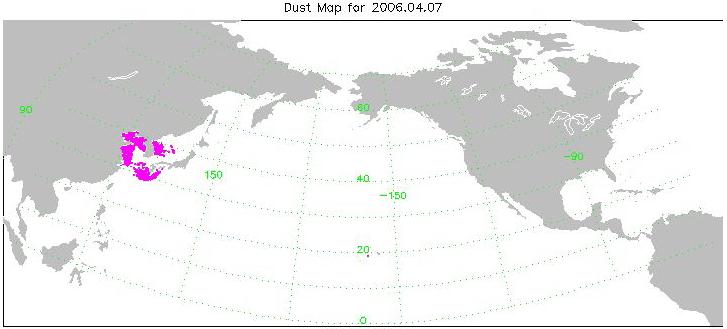
Click on image to view the movie
This animation is made from a series of images created with data from the
AIRS instrument. The animation spans 10 days beginning on April 7, 2006
and ending on April 16. The magenta color in the images represents where
AIRS detects dust in the atmosphere. The images are preliminary as
scientists work on verifying the accuracy of the AIRS ability to detect
dust, and an effort to cross-compare the AIRS results with what other
sensors see is just getting under way. However, the spatial consistency and
temporal evolution we see in the AIRS data look plausible, even over land.
The Atmospheric Infrared Sounder (AIRS) in conjunction with the Advanced
Microwave Sounding Unit (AMSU) sense emitted infrared and microwave
radiation from the Earth to provide a three-dimensional look at Earth's
weather and climate. Working in tandem, the two instruments can make
simultaneous observations all the way down to the Earth's surface, even in
the presence of heavy clouds. With more than 2,000 channels sensing
different regions of the atmosphere, the system creates a global, 3-D map
of atmospheric temperature and humidity, cloud amounts and heights,
greenhouse gas concentrations, and many other atmospheric phenomena. The
AIRS and AMSU fly onboard NASA's Aqua spacecraft and are managed by the
Jet Propulsion Laboratory, Pasadena, California, under contract to NASA.
JPL is a division of the California Institute of Technology in Pasadena.
The AIRS Public Web site can be found at http://airs.jpl.nasa.gov.

