Species Data Reveal Areas of High Biodiversity in the Americas, the World
See: Species Distribution Grids Web site
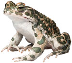 Human activities have contributed to habitat loss for a large number of species worldwide. In response, species mapping has become an increasingly important tool for conservation priority-setting and ecological modeling. Now a consortium of conservation organizations―NatureServe, IUCN, Conservation International, and World Wildlife Fund-USA―has developed a vast digital library of the distribution of birds and mammals of the Americas and amphibians of the world. To make these data more useful for a wide range of applications, CIESIN’s NASA-funded Socioeconomic Data and Applications Center (SEDAC) converted the entire collection of shapefiles to raster format at 1-km grid-cell resolution. Basic or advanced searches may be undertaken for species in each of the three classes—amphibia, aves, and mammalia—using any number of criteria including class, family, genus, and endangerment status according to the IUCN Red List. Users may download the search results as zip files, with a readme file explaining how to use the data and a full metadata record of each of the data sets bundled in the file. The Web site provides the original vector data (in ESRI shape file format), the original grids (a raster version of the vector data), and presence grids (raster data depicting the presence or absence for each species). The grids are distributed in GeoTIFF format.
In addition, SEDAC has created “richness grids” that describe the number of species by class and family found in each grid cell. Data sets include: Human activities have contributed to habitat loss for a large number of species worldwide. In response, species mapping has become an increasingly important tool for conservation priority-setting and ecological modeling. Now a consortium of conservation organizations―NatureServe, IUCN, Conservation International, and World Wildlife Fund-USA―has developed a vast digital library of the distribution of birds and mammals of the Americas and amphibians of the world. To make these data more useful for a wide range of applications, CIESIN’s NASA-funded Socioeconomic Data and Applications Center (SEDAC) converted the entire collection of shapefiles to raster format at 1-km grid-cell resolution. Basic or advanced searches may be undertaken for species in each of the three classes—amphibia, aves, and mammalia—using any number of criteria including class, family, genus, and endangerment status according to the IUCN Red List. Users may download the search results as zip files, with a readme file explaining how to use the data and a full metadata record of each of the data sets bundled in the file. The Web site provides the original vector data (in ESRI shape file format), the original grids (a raster version of the vector data), and presence grids (raster data depicting the presence or absence for each species). The grids are distributed in GeoTIFF format.
In addition, SEDAC has created “richness grids” that describe the number of species by class and family found in each grid cell. Data sets include:
• 5,810 species of amphibia
• 4,166 species of aves
• 1,716 species of mammalia
Users may download maps showing species richness at continental and global scales for each of the three classes.
|
