|
EDENapps Introduction
EDENapps is a series of independent EDEN tools that assist users in using the EDEN spatial data layers:
| Tool |
Purpose |
Screenshot |
| DataViewer |
Displays EDEN data layers including panning, zooming, and animation of multiple dates of water surface, depth, and days since dry; queries of data values, and generation of time-series graphs. |
 |
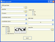
| xyLocator |
Returns values from EDEN data layers at specific x,y coordinates over a specified time period. Users can input a file with a list of sample site locations. |
 |
| Transect Plotter |
Select a point-to-point transect (not necessarily a straight line) and plots EDEN data profile over the time series, includes animation, plotting of observer data, and ground slope. |
 |
| Depth&DaysSinceDry |
EDEN Depth&DaysSinceDry is a program for creating daily surfaces (in NetCDF file format, .nc) of water depth and days since dry from EDEN daily water level surfaces and ground elevation model. |
 |
Download EDEN DEM file for ground elevation (.zip, 170 KB) for use in the tools above . Please note: This file is intended specifically for use in the EDEN applications software as elevation values have been converted from meters (m) to centimeters (cm) for use by EDEN applications software.
|
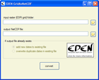
| GridtoNetCDF |
Creates NetCDF files from ESRI GRID files for any EDEN data layers. |
 |
| NetCDFtoGrid |
EDEN NetCDFtoGrid is a program for converting EDEN water level, water depth, and days since dry files from netCDF (.nc) format to ESRI Grid format.
|
 |
|
|
|
|

